PastlasHistorical atlas

What’s new

How the atlas has changed, newest first. If something looks wrong or is missing, tell us — corrections from readers are how it gets better.

Reads every entry’s title, summary and points. Every word you type must appear; capitals and accents do not matter.

Showing 80 of 80 entries

Jump to a date
  1. · v2.40.0

    The largest states under the timeline: empires rising and falling in every region

    • Timeline
    • Data and accuracy

    The Patterns strip gains a third layer: for each region, the ground its largest state held, year by year, from the borders the atlas measures.
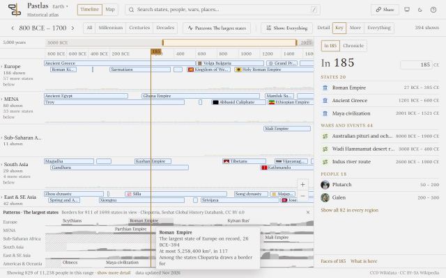
    • The largest states, under Patterns, draws a row per region: the ground the region’s largest state held each year, named where the name fits – Rome rising and gone, the caliphates in turn, the Han and the Tang between the years China was divided.
    • One scale for every region and every era, so the Mongol Empire’s 27 million km² and the Akkadian Empire’s half a million sit on the same ruler; a hover gives each state’s years at the top and the most ground it held.
    • Years in which no state of a region has a border drawn are hatched, and say so: that is how far the borders reach, not an empty land.
    • A state stands in the region of its seat, as in the lanes, so the Spanish Empire’s ground in the Americas counts to Europe – the hover says so.
  2. · v2.39.1

    More states named for what they were, and the map drawn in their own years

    • Map
    • Names and languages

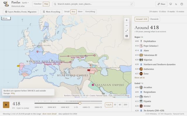
    Twenty-five more states take a better name, Denmark is one entry again, eight dates are corrected, and the map stops drawing Cabinda as Portugal’s and Suriname inside the Antilles.

    • Six more states are named for the state, not for an article about it: the Kingdom of Spain of 1874–1931, Bonapartist Spain, the Swiss Confederation of 1815–1848, Dutch Guiana, Norse Greenland and the Gutian dynasty of Sumer.
    • Nineteen more states of the Zhou era read alike – State of Ju, State of Xing, State of Eastern Zhou – and sixteen of them leave the Location unknown lane for East Asia, at their capitals.
    • Denmark is one entry again, holding the events the Danish Realm held beside it; the Pannonian Avars are part of the Avar Khaganate; and four entries that were never states of their own are gone, among them “Federalism in Switzerland” and a second Byzantine Empire.
    • Dates: the Kingdom of Kerma from 2500 BCE, the Hunnic Empire from 370 to 469, the Inca Empire to 1533, Norse Greenland from 985 to 1450, and the Allies of the Second World War to 1945.
    • On the map, Cabinda is Angola’s after 1975, Suriname is no longer drawn inside the Netherlands Antilles, Germany holds nothing in Cameroon before 1884, the Inca Empire no longer covers the Andes after its fall, and the shape at Quito in 1812 is the State of Quito.
  3. · v2.39.0

    Patterns under the timeline: instability, eruptions and plagues across every era

    • Timeline
    • Data and accuracy

    A strip under the lanes draws one series across the whole range, on the timeline’s own years and cursor, with its coverage and its sources beside it.

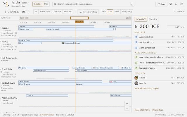
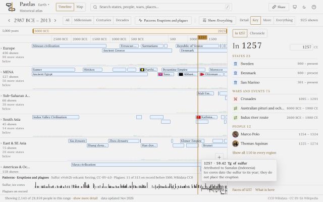
    • Patterns, beside the zoom, opens a strip under the timeline. Instability on record draws, for each region and half-century, the share of what was written down that was risings, regime changes or massacres.
    • Where the record is too thin to say - too few states alive, too few events written down - the half-century is hatched and says why on hover. A quiet record is not a calm century.
    • Eruptions and plagues draws the sulfur the ice cores hold, from 3000 BCE to the present, and the plagues the atlas records, each across its years, so a volcanic winter and an epidemic line up under the states they struck.
    • Every mark answers a hover, the cursor runs across the strip as it does across the lanes, and the link keeps the layer: a shared view opens on the same strip.
  4. · v2.38.1

    States named for what they were, not for an article about them

    • Map
    • Names and languages

    Fifty-two states take a better name, six entries that were never states of their own leave, and the map prints the names its borders were ruled to carry.

    • The Hunnic Empire is the Hunnic Empire again, not “History of the Huns”; Anglo-Saxon England, Old Kedah and the Swiss Confederation of 1803–1815 are named for the state, not for an article about it.
    • Korean states take one spelling - Baekje, Gojoseon, Balhae, Gaya - as Joseon and Goryeo already had, and every state of the Zhou era reads alike: State of Qin, State of Chu, State of Lu. The names they had before still find them in search.
    • Names that had lost the words telling them apart get them back: the Mamluk dynasty of Delhi, the Gold Coast Colony, Later Han of the Five Dynasties.
    • Five entries that were articles about a country rather than a state - among them “Politics of China” and a second Sweden - are gone, and German colonization of Africa is folded into the German colonial empire.
    • The map no longer prints “History of Sumer”, “Fidel Castro” or “Peloponnesian War” over the Sumerian city-states, the Cuban Nationalists of 1898 or the Athenian coalition: 24 territories print the names they were ruled to carry.
  5. · v2.38.0

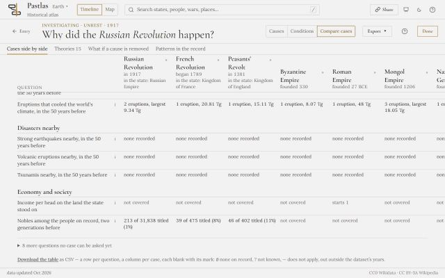
    Twelve cases side by side, and the table as a file

    • Investigate
    • Theories

    Compare cases now holds twelve entries, the table downloads as a spreadsheet, and its wars row reads the same wars the theories beside it read.

    • Add up to twelve cases; past six the table scrolls sideways rather than crush the names.
    • Download the table as CSV: a row per question, a column per case, every cell in its own words and every blank with its reason - none on record, not known, does not apply, outside the dataset's years.
    • The question of which wars a state was in now counts the wars it hosted and the ones the atlas's own table gives it, as the theories do - so Russia in 1917 is in the First World War in both.
  6. · v2.37.0

    Fix an entry at its source, or suggest a cause

    • Data and accuracy

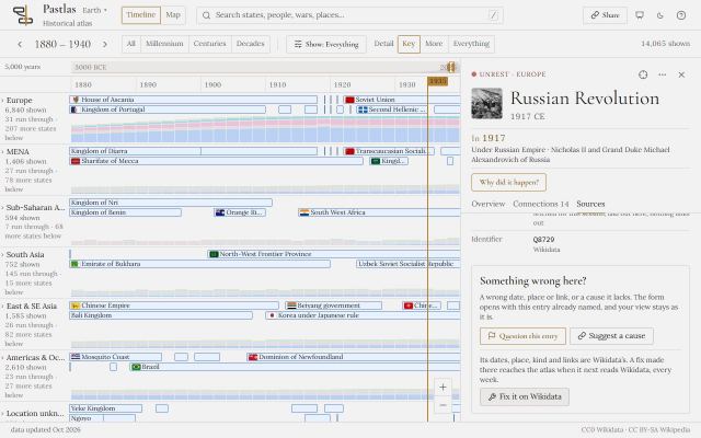
    Every entry's Sources now ends with what you can do about it: question it, suggest a cause it lacks, or fix it on Wikidata, where most of what it says comes from.

    • Fix it on Wikidata opens the entry's own item, ready to edit. Its dates, place, kind and links are Wikidata's, and the atlas reads Wikidata again every week, so a fix made there comes back here.
    • Suggest a cause, on every event and state, opens the form with the entry named and "a cause or a consequence" chosen: say what led to it, and which source says so.
    • Rows the atlas made itself, such as its pirate captures, have no Wikidata item and no such link.
  7. · v2.36.1

    The states that fought the Second World War are read as at war

    • Theories
    • Data and accuracy

    Wikidata names only a handful of states as fighting the Second World War, so the theories read France, Poland, Canada and Italy as at peace. The atlas's own table of who fought now holds the Second World War too, each state in the years it fought.

    • France, Poland, Canada, Italy, Hungary, Romania, Greece, Yugoslavia, Brazil and the rest of the Second World War's belligerents are read as at war in the years each fought - France's Third Republic to 1940, Free France from 1940, Brazil from 1942.
    • India's risings of 1946, Brazil's coup of 1945 and the Czechoslovak coup of 1948 now meet Skocpol's war and revolution or Goldstone's fiscal strain; 17 theory readings are gained, and none is lost.
    • A war read from the atlas's table gives the state's own years - fought from 1942, fought to 1942 - where "ended 1942" would have misread the war.
  8. · v2.36.0

    Tell us what we got wrong: the feedback form is open

    • Data and accuracy

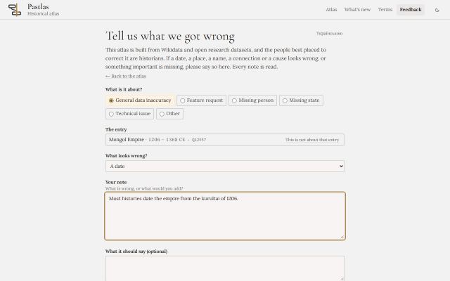
    Every entry can now be questioned. The form opens with the entry already named, asks what looks wrong and what your source says, and every note reaches the atlas's team.

    • Question this entry, in every entry's panel and on every state's page, opens the form with the entry named; Report a problem in Help opens it for anything else.
    • Say what the note is about - an inaccuracy in the data, a missing person or state, a feature you would like, a technical issue - and, for an entry, what looks wrong: a date, a place, a name, a connection, a cause.
    • Your name and email are optional, used only to reply or, if you tick the box, to thank you by name in this changelog. The form speaks English and Ukrainian.
  9. · v2.35.1

    The states that fought the First World War are read as at war

    • Theories
    • Data and accuracy

    Wikidata names only six states as fighting the First World War, so the theories read Russia in 1917 as at peace. The atlas now keeps its own table of who fought the wars Wikidata leaves them out of, with the years each fought.

    • Russia, Germany, Austria-Hungary, the Ottoman Empire, France, Italy, Serbia, Belgium, Romania, Bulgaria and the rest of the First World War's belligerents are read as at war in the years each fought - Italy from 1915, Greece from 1917.
    • The Russian Revolution, the February Revolution and the July Days now meet Skocpol's war and revolution and Goldstone's fiscal strain; 30 theory readings change in all, and none is lost.
    • A war read from the atlas's table says so under the theory: a party by the atlas's reading, not Wikidata's.
  10. · v2.35.0

    The fourth generation of revolution theory joins the library, and every theory of revolution carries its generation

    • Investigate
    • Theories
    • Data and accuracy

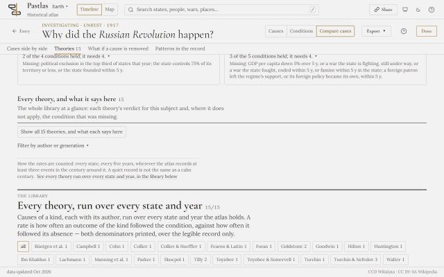
    Four theories that put the political process first - Foran's political cultures of opposition, Lachmann's elite conflict, Goodwin's state that leaves no other way out, and Goldstone's five conditions of 2014 - are tested over every state and year beside the eleven, read from V-Dem's coding of who supported each regime and who opposed it since 1789. Every theory of revolution now says which generation it belongs to, the library filters by it, and the third generation is set against the fourth in one table.

    • Fifteen theories: the four of the fourth generation join Goldstone, Turchin, Ibn Khaldun, Huntington, Skocpol, Tilly, Hilton, the climate historians, Fearon and Laitin, Collier and Toynbee, each with its sources, its objection and its conditions checked one by one.
    • Tilly's later work - Trust and Rule, Regimes and Repertoires - extends his multiple sovereignty: a state that no longer controls its territory, and a civil society withdrawing from public politics, now count.
    • V-Dem's evidence reaches the states that held a territory, not only the country of today: the Russian Empire and the Soviet Union read Russia's coding, the Ottoman Empire Turkey's, the Third Republic France's, Qajar and Pahlavi Iran Iran's - 95% of risings since 1789, where 188 cases could be read before.
    • Filter the library by generation - II, III, IV, or the theories of something else - beside the author filter; the choice travels in the link. A table in the library and in the guide sets the third generation against the fourth: where a revolution begins, what ideas do, how it unfolds, whose cases, and what the atlas can test of each.
    • A theory of successful revolution is asked only of the risings that succeeded, as each article's infobox says - “Revolutionary victory”, “Uprising suppressed” - read for 1,127 risings and regime changes; a rising the atlas has not read for its ending is kept apart, never counted as a failure.
    • Cases side by side gains six rows from V-Dem: who supported the regime and who opposed it, how personal and how exclusionary the rule was, movements against the system and mobilisation, political killings, the share of territory the state controlled, and civil society - each 1789 or 1900 on.
    • How the theories compare, 1900 to 2014: every theory asked at once over every state-year the record is awake for, with what each adds when the others are already asked, under the library's filters.
    • Every threshold was fixed by measurement before any rule was: each condition's share in the years before a rising against ordinary years, printed and read, then set.
  11. · v2.34.0

    France and Rome are drawn as the states that held them

    • Timeline
    • Data and accuracy

    France was one bar from 481 to today, laid over Francia and every French state after it, and Ancient Rome one bar from 753 BCE that took the place of the Roman Kingdom and Republic. Now the timeline draws the states that held them, one after another.

    • France is drawn as Francia, West Francia, the Kingdom of France and each republic and empire after them; Rome as the Roman Kingdom, the Republic, the Empire and the Western Empire.
    • The same for the Savoyard state and the Kingdom of Sardinia of 1324–1861: the County and the Duchy of Savoy, and Sardinia's three kingdoms.
    • A link to France or to Ancient Rome opens the state of the year on screen, and their pages list the states that held them, each with its years.
    • A ruler's lines no longer list the country beside the state: Romulus is in the Roman Kingdom's line.
    • Maddison's GDP per capita over the land that is now France reads under each French state.
    • 186 of the 438 pharaohs Wikidata names without a year now carry the reign their own article gives, held to their lives - 369 reigns across the atlas - and the ruler's panel says whose years they are.
  12. · v2.33.0

    Two things of one name are told apart, and a dynasty held beside its state is the state

    • Names and languages
    • Data and accuracy

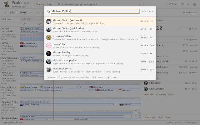
    1,746 events and people printed a name another row also printed - Michael Collins the astronaut and the Irish leader, eleven Russo-Turkish Wars, two Treaties of Tartu. Each now carries its English article's name in full, and the atlas holds no event and no state twice where it found one: ten dynasties held beside the states they ruled are those states.

    • Events and people that share a name are told apart as their articles tell them: "Michael Collins (astronaut)", "Treaty of Tartu (Estonia–Russia)", "Solomon, King of Hungary". Search still finds them by the shorter name.
    • Where no English article tells two apart, the atlas names them from Wikidata's own descriptions: "Peace of Basel (France–Spain)", "Battle of Kruty (2022)"; and a Hyksos king Wikidata's English label calls Sheshi is Bnon.
    • One event held twice is one: the Siege of Janjira of 1682. The Battle of Cape Fear River, written by hand for the pirates while Wikidata had no entry for it, is Wikidata's own now, and Stede Bonnet is linked to it.
    • Ten states held twice are one, each with its borders, its rulers and what it hosted: the Safavid, Qajar, Pahlavi and Afsharid dynasties are their Iran, the Almohads their caliphate, the Attalids the Kingdom of Pergamon, the Rashidis Jabal Shammar, the Dogras Jammu and Kashmir, the Zayyanids the Kingdom of Tlemcen, the Sabaeans Sheba.
    • The Savoyard state and the Kingdom of Sardinia of 1324–1861 hand what they hold to the state of its day - the County or the Duchy of Savoy, or one of Sardinia's three kingdoms - and the Aragonese kingdom of Sardinia ends in 1720, not 1848.
    • The atlas's reading of articles no longer takes a bare war's name for whichever war held it: "the Russo-Turkish War" of 1829 had been read as the war of 1877.
  13. · v2.32.0

    A ruler is placed by what the sources state, never by a name that sounds alike

    • Data and accuracy

    The atlas used to place a ruler, a prime minister or a period in a state whose name shared a word with the office - and mostly guessed right, but filed the Countess of Jaffa under the Jaffna kingdom of Sri Lanka and Udaipur's maharanas under another Udaipur. Now an office goes where Wikidata seats it, where the article's own link leads, or where a table read row by row puts it, and nowhere otherwise.

    • Romania's, Bulgaria's, Hungary's, Egypt's and Japan's prime ministers stand in their kingdoms and empires by a pair read and kept by hand, each with its reason; the Kingdom of Hungary's government now holds Teleki, Gömbös and Bárdossy, whom the old rule could not tell from Hungary's other forms.
    • A ruler's article places his reign by the office it links - its seat in Wikidata, a page that leads to the state, or one of 134 offices tied by hand, from the King of Denmark to the Emperor of Bulgaria - and by no word of its title.
    • What the old rule got wrong is undone: Mewar's maharanas leave the Udaipur of Chhattisgarh, the Ottoman sultans leave Ottoman Greece, Lebanon's presidents leave the French Mandate, Kerensky leaves the Soviet republic.
    • Seshat's figures join the atlas by a table of its own codes for each state; its early-medieval Bulgaria now describes the First Bulgarian Empire, not the Bulgaria of 1990.
    • Japan's shogunates show their emperors as their rulers and their shoguns beside them, as a kingdom shows its prime ministers: the Tokugawa shogunate's fifteen shoguns, from Ieyasu to Yoshinobu, stand beside the emperors from Go-Yozei to Meiji.
    • A line of rulers read from their articles follows the succession itself, not the title: a king who proclaimed himself emperor stays in his line, a king deposed and restored keeps every reign, and a partition, another crown of the same king or a new state ends it.
  14. · v2.31.0

    Every state says what kind of thing it is, and a man, a war or a party is no longer one

    • Timeline
    • Data and accuracy

    The atlas filed 372 rows as states that Wikidata says are something else: cities, peoples, civilisations, periods, royal houses, parties - and a man, Fidel Castro, and a war, the Peloponnesian. Each now says what it is, and what is not a state has left the states: Berlin and Vienna, the Houses of Tudor and Romanov, the Chinese Communist Party.

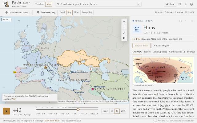
    • Every state carries its kind, read from Wikidata's own classes: a state, or a city-state, a people, a civilisation, a period, a region, a dynasty, a royal house or a city the atlas keeps as the state it ruled. The panel's head and the state's page say it - "People" for the Huns, "Civilisation" for Ancient Greece, "City-state" for Uruk.
    • 147 rows leave the states: cities, royal houses and dynasties with no ground of their own, Hasidic courts, and the ground the borders dataset draws for a faction under a man's, a war's or a party's name - the Cuban insurgents of 1895 filed as Fidel Castro, the Athenian coalition as the Peloponnesian War. Their polygons stay on the map under their own names.
    • Where Wikidata's item is the office, the family or the sect of a real state, the state stays and says so: the Nawabs' Bengal, the Sultanate of Perak, the Qarmatian state of Bahrain, the Frisian Kingdom.
    • Eleven of those items come back as what they are: Fidel Castro and Lysimachus as rulers, the Peloponnesian War and the Central Plains War as wars.
    • A royal house's or a dynasty's line goes to the state Wikidata seats its throne in: Morocco's line now runs through the Alawi sultans from al-Rashid, Luxembourg's through its grand dukes of 1890-1964, the Mamluk Sultanate's through the Burji sultans. A title, a mayoralty or a seat goes nowhere, and is listed.
  15. · v2.30.0

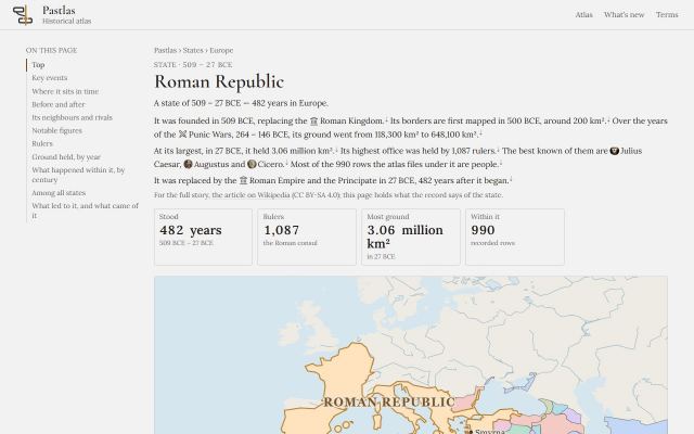
    A state's page reads like a page of a printed atlas

    • Design and reading
    • Sharing and links

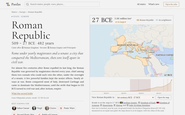
    Every state's page is redrawn to the atlas's second design: its name large, its dates under it, a line that says what it was, and the facts a reader came for each set against a familiar one - 482 years, longer than the Parthian Empire; 3.06 million km², about the size of India. The best-known states are retold in acts from their own articles, each act opening on its own map; their people stand on one axis, their government as a strip of years, their world beside them, and every number of method is gathered at the foot of the page.

    • The hero: the state's name, its years, what came before and after it, a line and a lead retold from its English Wikipedia article for the best-known states, who and what it is best known for, and four facts with a comparison each - its years among the states that ended, its ground among the countries of today, its rulers or its magistrates a year, its wars per century. Beside it the map at its largest, its ground year by year, its neighbours named and the map in any century it stood.
    • The story in acts: two to five chapters of its life for the states told from their articles, each with the state's ground at its end drawn on its own small map, its events and its people, and a door to the live map at its first year; the record's own account of the state is one click under the lead.
    • Its people on one axis, ordered by birth, a holder of its office named by the office - Bayezid I a sultan and a poet - and the years they lived on after it hatched; how it was governed as a strip of years for an office held by several at once, a ribbon of reigns for one held alone, with how the terms ended counted beside who held it longest; every term, with its filter, behind one click.
    • Its world: the states it met in most wars and battles, and the best-known states of the other regions that stood with it - Ming, the Mughals, the Inca beside the Ottomans rather than eight countries of Europe. How it compares: three distributions of every state, with two familiar names marked on each.
    • Why it fell, or how it began: a line from its article, three numbers of its last century, its centuries in the record linked to each century's own page, and one action - the investigation where three causes are on record, its last century on the timeline where fewer are. A bar of its sections stays along the top; what a reader needs to trust the page is gathered at its foot.
    • The header of every page searches the atlas, even with no script: the words typed open the atlas's search on them.
  16. · v2.29.0

    Hugh Capet opens the Kingdom of France, and no reign is dropped unseen

    • Rulers and reigns
    • Data and accuracy

    The Kingdom of France's line now begins with Hugh Capet in 987, not Philip II in 1180; the Third Republic holds its presidents; Greece, Romania, Bulgaria and Hungary have their kings' prime ministers; a reign that ran across a change of state stands in both; a reign recorded twice is drawn once; and every term of office the atlas reads but cannot place is listed with its reason.

    • A term of office that falls outside the years of the state Wikidata files it under goes to the state on that ground in its year: Hugh Capet and the Capetians to the Kingdom of France, the prime ministers of the Kingdoms of Greece, Romania, Bulgaria and Hungary to their kingdoms, the kings of Ayutthaya to Ayutthaya. Terms of office on record rise from 26,743 to 27,000.
    • A country's rulers are the rulers of its form of the day: Thiers, MacMahon and Poincare are in the Third Republic's line, Mazarin heads the Kingdom of France's government, Trochu and Cavaignac belong to the republics they led.
    • A reign that ran on across a change of state stands in both states' lines: the last sultan of the Maldive Islands is the Maldives' from 1965 too.
    • One reign is drawn once: 73 doubled terms - Gorm the Old's reign recorded from 934 and again from 936, Poland's kings from two sources - are one.
    • Offices that are not a state's throne no longer fill its line: no commanders of every age in Hasmonean Judea's, no prime ministers of other countries in the Dominion of India's, no traditional chiefs in Cameroon's.
    • Every term the atlas reads but cannot place, 2,503 of them, is listed with the reason it stands nowhere, for reading by hand.
  17. · v2.28.0

    A ruler belongs to the state whose line holds them, and an empty state says why

    • Rulers and reigns
    • Data and accuracy

    Sargon of Akkad is the Akkadian Empire's, which he founded; the presidents of the Fifth Republic are the Fifth's and not the Fourth's or the Third's of their birth years; the Scythian kings are the Scythians'; and a person or event the atlas cannot place under a state now says why - a legendary figure, a state the atlas does not hold, a place wider than one state.

    • A ruler is hosted by the state whose line of rulers holds them, as the lines stand: the host join read a sweep taken outside the build and missed every line the build had read since - the Parthian and Hittite kings, Louis VI and VII of France. 220 rulers found their state this way; rulers with no state and no reason fall from 78 to 0.
    • The state of a ruler's day is the state of their term, not of their birth: Hollande and Sarkozy leave the Fourth Republic for the Fifth, de Gaulle, Mitterrand and Chirac the Third; anyone else who is no ruler keeps the state of the year they were born.
    • Where a person died is read last, after citizenship, birthplace and work: the country standing there in the year of their death, else the border holding the place.
    • The Scythians and the Cimmerians host their kings - Ateas, Idanthyrsus, Madyes - whose lines the atlas already drew under no state.
    • Every person and event with no state says why in its panel - a legendary figure, a ruler of a state the atlas does not hold, a place wider than one state, several states crossed, none standing in its year - in place of 'No state attributed'.
  18. · v2.27.0

    A state's dates are picked by rule, and read where the witnesses disagree

    • Timeline
    • Data and accuracy

    Where Wikidata records more than one founding or end for a state, the atlas now chooses by rule - the year the state's own article gives, else the one its first ruler reigned from, else the earliest - instead of keeping whichever row arrived first: the Akkadian Empire begins in 2334 BCE with Sargon, Macedonia in the 7th century BCE rather than with a legend, and every state a witness contradicts is listed for reading.

    • 47 states begin in another year than before and 35 end in another, each chosen among Wikidata's own statements by its article's infobox, the line of its rulers or the earliest founding; the entry panel says which years Wikidata holds and which clause chose.
    • The Akkadian Empire begins in 2334 BCE, the year Sargon took the throne, not 2270 BCE: both are Wikidata's, and the article's infobox and the line of its kings agree on the first.
    • The Byzantine Empire keeps 330, chosen now rather than by the luck of the row, beside Wikidata's 285, 286 and a preferred 395; Russia keeps the atlas's ruling of 1991.
    • Macedonia is dated from the 7th century BCE, with Perdiccas I, rather than from 808 BCE, the legendary founding by Caranus; Classical Athens runs from Cleisthenes in 508 BCE to the Lamian War of 322 BCE, where it had stood as a single year in 701 BCE.
    • Every state whose span a witness contradicts by more than ten years - its article, the borders dataset, its own line of rulers - is listed for reading, with the other dates Wikidata holds beside it: 1,307 on the first day, a number that may only fall.
  19. · v2.26.0

    The atlas audits its own record, and the lines of rulers reach further

    • Rulers and reigns
    • Data and accuracy

    A full revision of every state, ruler and event has begun: the atlas now measures what its record lacks - rulers with no state, reigns outside their state's years, wars filed under a state that did not fight them, the same event twice - and holds every number from growing. The first findings are fixed: a cartoon leaves Scotland's throne, twelve Ottoman consorts leave its line, and 711 reigns the articles name are back in their lines - restored monarchs among them.

    • An audit of the record, written with every build: twenty-two measures of empties, discrepancies and duplicates, each with the rows it names, best known first. A number may only fall; the branches of the revision that follow bring each to zero.
    • Macbeth (Gargoyles), a character of a cartoon, no longer holds Scotland's throne from 1040 to 1057 beside the king: a fictional character is not a person the articles' reader admits.
    • The articles' reader follows a line of rulers along predecessors and successors as far as it goes: a cap that counted pages had stopped it at the second link, and the Kanem-Bornu Empire's mais, France's kings of the fourteenth century and Buganda's kabakas were left out.
    • A monarch restored to the throne has every reign: an infobox writes the later ones as a reign with a predecessor and no office of its own, and the reader had skipped them - Abu'l-Hasan Ali of Granada's 1482–1485, Abdallah of Morocco's five reigns, the princes of Wallachia and Moldavia, the khans of the Golden Horde and the Crimea. 164 reigns on 133 pages.
    • A field is read wherever it begins on its line: Hadj Moustapha, seventh dey of Algiers, had his office written after his caption and was lost with the two deys before him; Leopold II of Lippe's office had swallowed his reign.
    • A haseki, the Ottoman sultan's chief consort, holds no throne: twelve consorts of the 1500s and 1600s, read as the Ottoman Empire's rulers because the '(Chief Consort)' beside the title was set aside as an aside, leave its line, and so does Turhan Sultan's regency.
    • Together the articles name 9,441 reigns where they named 8,745; the twenty that moved were re-dated by the holder's own page, which the chain now reaches.
    • A reign an infobox writes as a circa with a note is read as a reign; the Akkadian Empire's own list of its kings had given Sargon no years.
    • Sargon of Akkad is still without his empire for one more branch: the atlas dates the Akkadian Empire from 2270 BCE, one of the two foundings Wikidata records, and the next branch picks a state's dates by rule and reads every disagreement.
  20. · v2.25.0

    What's new shows each change moving

    • Sharing and links

    An entry on this page now carries a few seconds of film of the change it describes, recorded from the atlas itself: open an entry to watch it, or see its still on the list.

    • On an entry's own page the film plays silently and loops, with its controls; on the list each entry shows a still that opens the page.
    • Twenty-seven of the past entries have been filmed after the fact, so a change looks as the atlas draws it today; a correction to the record or a change of speed is not filmed, since there is nothing to watch.
    • The films are small MP4 files that every browser plays, made with the same video library the map's export uses.
  21. · v2.24.0

    Play says what happens as the years go by

    • Timeline
    • Map

    While the years play, the best-known events they pass are named as they go - the Fall of Constantinople as 1453 goes by - a few at a time, slowly enough to read.

    • The notes are the events the map or the timeline is showing at its level of detail, the best known first: at forty years a second the atlas passes more than anyone could read, so it names one at a time.
    • Click a note to stop and open the event. A pause keeps the notes on screen; moving the year by hand clears them.
    • They play in presentation mode too, for a room following along.
  22. · v2.23.0

    Flags, faces and kinds beside every name on the atlas's pages

    • Map
    • Design and reading

    On the pages of states, rulers, years and centuries, every state now wears its flag, every person their portrait and every event the mark of its kind; a state's rise and fall is one map to wipe across; and a wide page lists its sections at its left.

    • A state's flag is the one it flew in the year the line is about: a neighbour's in the year of the map, a predecessor's when the state began, a successor's when it ended, a rival's in their best-known war.
    • The names in a state's story wear their marks too. A person with no portrait and a state with no flag on record keep the mark of their kind.
    • The first and the last maps of a state's borders lie in one frame: drag across it, tap it or use the arrow keys to wipe from one year to the other.
    • On a wide screen the page of a state, a year, a decade or a century keeps a list of its sections at its left as you scroll, and marks the one in view where the browser can.
    • The flags and portraits are Wikimedia Commons files, each under its own licence, as each page's footer says.
  23. · v2.22.0

    Presentation mode, for showing the atlas to a room

    • Timeline
    • Map
    • Sharing and links

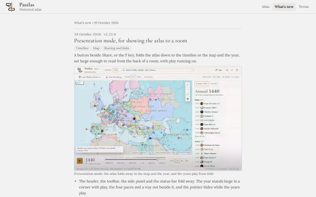
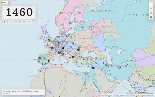
    A button beside Share, or the F key, folds the atlas down to the timeline or the map and the year, set large enough to read from the back of a room, with play running on.

    • The header, the toolbar, the side panel and the status bar fold away. The year stands large in a corner with play, the four paces and a way out beside it, and the pointer hides while the years play.
    • On the timeline the window turns a page when play carries the year past its edge, so the year never leaves the screen.
    • F enters and leaves, Esc leaves, Space plays and pauses, and 1 to 4 choose the pace. A click along the top edge brings the atlas back too.
    • The address carries it: a link to a presentation opens presenting, at the view, the year and the pace it was made with. On a wide screen; a phone keeps its own layout.
  24. · v2.21.0

    The map can leave the atlas as a video

    • Map
    • Sharing and links

    The map playing through the years can now be saved as a video file to post: choose the years and the pace, and the borders move with the year large and the credits on every frame.

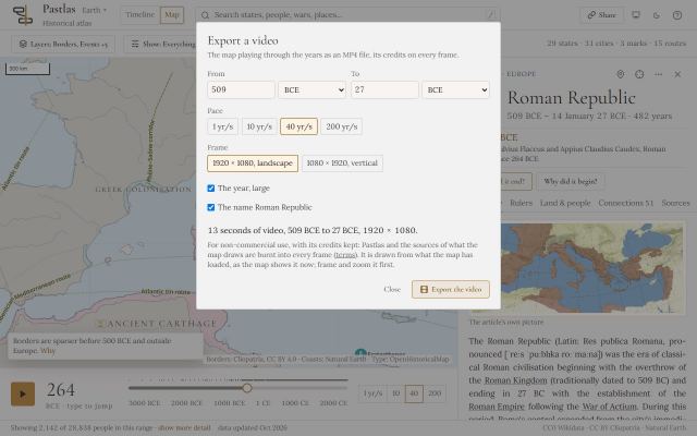
    • Export a video, under the map's zoom buttons: the years, the pace, a landscape or a vertical frame, and whether the year and the chosen state's name are shown. The atlas draws the map year by year and saves an MP4 file.
    • Every frame carries the credit and the sources of what the map draws, as the map's own credit line names them.
    • In Chrome and Edge the video is H.264, which every platform takes; a browser without that encoder writes VP9 into the same MP4 file. The Roman Republic from 264 to 146 BCE at forty years a second is 4 seconds of 1920 by 1080 video, under a megabyte, made in about a minute.
    • The videos are for non-commercial use, with their credits kept.
  25. · v2.20.0

    A state's page opens on its story, written from the record

    • Design and reading

    Each state's page now opens on its story in up to three short paragraphs: how it rose, what it held and who ruled it, and how it ended. Every sentence comes from the atlas's own facts, with a mark that leads to the section showing that fact.

    • The story is written from the record, not by a language model and not from Wikipedia's words: a fact the record does not hold drops its sentence rather than becoming a vaguer one.
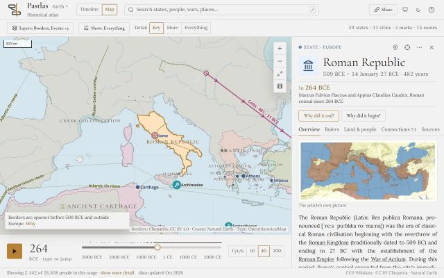
    • The Roman Republic's begins: founded in 509 BCE, replacing the Roman Kingdom; first mapped at 200 km²; over the years of the Punic Wars its ground went from 118,300 km² to 648,100.
    • The years of a war are told, never made its cause: the story says what the ground was before and after, and leaves the why to the theories.
    • The Ground held section now gives a state's largest extent from its whole series, the same figure as the Most ground tile; it had read a sampled one, so Byzantium's page said 2.38 million km² in one place and 2.60 million in another.
    • Every story is checked against every other and against its article: no paragraph is another state's with the names changed, and none repeats ten words of the article.
  26. · v2.19.0

    A state's page names its neighbours and rivals

    • Map
    • Design and reading

    A state's page now looks sideways as well as back and forward: the states around it on its map, the states it met in war, and the states that stood beside it in its region.

    • Neighbours on the map: the states the page's own map draws around it, in the year it held the most ground.
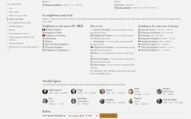
    • Met in war: the states named in the same wars and battles, with how many and the best known of them, as Carthage for the Roman Republic, in 23 wars and battles. On whichever side: the record names who took part, not who fought whom.
    • Standing at the same time: the best-known states of its region that overlapped it for long enough, so the list is not every state that ever touched its years.
    • Each name opens that state's own page, so the pages of states now lead to one another.
  27. · v2.18.0

    A state's page shows its notable figures, and how its reigns ended at a glance

    • Rulers and reigns
    • Design and reading

    The rulers' section of a state's page is now the part worth reading: the faces of the people a reader comes for, how the reigns ended as one bar you can filter by, and the line by century.

    • Notable figures: the ten best-known people of each state, rulers or not, with their faces. The Roman Republic opens on Julius Caesar, Virgil, Cicero, Ovid and Horace.
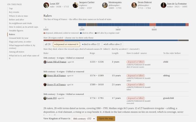
    • How the reigns ended, as one bar in the colours the ribbon uses: killed, deposed, died in office, left office alive. Choose one and the table shows only those reigns, with no script needed.
    • The table of rulers is grouped by century, each heading counting its reigns and those killed or removed, and every row has the ruler's face, how the reign ended as a coloured tag naming its source, how they died where it is known, and their age when they came to power.
    • A long line shows its first and last 36 reigns, with a link to the whole line in the atlas between them.
  28. · v2.17.0

    A state's page shows its key events, and opens the map in their years

    • Map
    • Design and reading

    A state's page now opens on the few events a reader came for, each a way into the atlas at its own years, and its ground chart shows where they fell.

    • Up to five key events on each state's page: its best-known wars, battles, risings and changes of regime. A war within a war is folded into it, so the Roman Republic shows the Punic Wars once, with the three wars within them, and Cannae and Alesia beside them.
    • Each card gives the event's dates and kind, how it ended where its article says so, and the ground the state held before and after it where the borders are mapped in both years, as the Punic Wars took the Republic from 118,300 km² to 648,100.
    • Watch the borders opens the live map in the year the event began with the state selected; On the timeline opens the event among everything else of its years.
    • The Ground held chart shades each key event's years, with its name on hover.
    • State pages are lighter, by as much as a fifth for the longest lines of rulers, with nothing on them looking different.
  29. · v2.16.1

    A state that joined a long war is at war only in its own years of it

    • Investigate
    • Theories

    The theories of instability read a state as at war through every war it took part in, from the war's first year to its last, even where it joined decades in. They now read a long war only in the years the state itself fought it.

    • A war of ten years or less counts whole for every state that fought it; a longer one counts for a state that only took part in it from its own first battle or campaign of that war to its last, unless the war is a part of a larger one the state was a principal of, as the Fernandine Wars were of England's Hundred Years' War.
    • The Central African Republic is no longer read as at war from 1987 in the Lord's Resistance Army's insurgency, which reached it two decades later, and a series of wars named as one, like the Indochina wars of 1946 to 1989, no longer counts as a single war for every state in it.
    • Forty-two fewer fits across the theories; the verdicts that changed are the ones that rested on a war a state was not yet, or no longer, fighting.
  30. · v2.16.0

    A state's map can go on your own page, and answer engines can cite the atlas

    • Map
    • Sharing and links

    Two ways the atlas travels beyond its own pages: a map you can put in a post, and pages an AI assistant can read and cite properly.

    • Under a state's map, Embed this map gives the code to put the map in your own page or post: the state in the year it held the most ground, with its credits and a link back to the live atlas, at a few dozen kilobytes. It is free to embed for non-commercial use.
    • Every state's page and every hub has a plain Markdown version beside it with the same text, for the tools that read Markdown.
    • The atlas's guide for AI assistants now says how to cite a page: the address of each kind of page, an example, and what may be reused.
  31. · v2.15.0

    A state's page keeps the live map at hand, and shows its rise and fall in one frame

    • Map
    • Design and reading

    Three more ways the pages of states and rulers lead into the atlas and read on a phone.

    • On a state's page a bar at the foot of the screen, once its map has scrolled by, opens the state on the live map in any century it stood, at the year it held the most ground in that century; it works with scripts turned off.
    • On a ruler's page the same bar opens their state on the map in the years of their longest reign.
    • On a phone the maps of a state's rise and fall show one at a time at full width, with a stop for each year, so the ground grows or shrinks in the same frame.
    • Search engines now read a state's page as a place, with its location where the record has its own and with its maps.
  32. · v2.14.0

    A state's page leads into the live map, and a shared link shows its map

    • Map
    • Design and reading
    • Sharing and links

    The pages of states, rulers, years and centuries exist to be found and then to lead into the atlas, and the way in was the last block of the page. It now sits near the top, and a link to a page shows a picture wherever it is pasted.

    • On a state's page the map opens the live map in the year it draws, with the state selected; each of its smaller maps opens its own year.
    • Open in the atlas sits under the map, or under the opening paragraph on the pages of rulers, years, decades and centuries, and says where each link goes: watch its borders from its first year to its largest, see everything that stood beside it, investigate why it fell.
    • A link to the page of one of the 500 best-known states shows a picture where it is shared: the state in the year it held the most ground, with the flag or arms it flew that year. A century's page shows the century's numbers.
    • No page offers a picture that chats and social networks cannot show; every other page shows the atlas's own.
    • In an entry's panel, More now copies a link to the entry's own page as well as to the view, and only the page's link shows a picture when shared.
  33. · v2.13.2

    Every ruler of a line is an entry, wars belong to their states, and events carry their own dates

    • Timeline
    • Rulers and reigns
    • Data and accuracy

    A week of reading the record again, line by line and article by article, and of making what is open load and move faster.

    • Every holder of a line of rulers is now an entry of their own, however few encyclopaedias wrote them up, from the highest office, the head of government and the formal head, dated by their years in office where their birth or death is not known.
    • A ruler is filed under the state they are known for, Lenin and Mao among them, rather than the first state whose office they held.
    • A war belongs to the states that fought it: the Mithridatic Wars are Rome's and Pontus's, not Cappadocia's, and 47 more wars moved the same way. Rome's wars are the Kingdom's, the Republic's or the Empire's, never a state called Ancient Rome.
    • Every event was read against the first sentence of its own article: 39 wrong dates are corrected - the Convention of Kanagawa is 1854, not 1864 - and 45 wars and crises the article calls ongoing now run to the present, the Russo-Ukrainian war among them, where they stood as a single year.
    • The Battle of France is the French Third Republic's, and every earthquake, eruption and tsunami is filed under the state that held its place that year.
    • Opening a state's line of rulers, or the theories about its history, downloads only what that state needs rather than the whole record.
    • Scrubbing through the years with every map layer on is smoother: four slow spots, found by measuring each frame, are gone.
  34. · v2.13.1

    The atlas starts a second sooner

    • Timeline

    Every start of the atlas built its search index, sometimes three times over, whether or not you searched, and placed each of ten thousand earthquakes, eruptions and tsunamis by measuring its distance to every state on record. Both now cost less: the index is built when you first search, and each event is measured only against the states of its own region.

    • An entry opened from a link is on screen about a second sooner.
    • Search answers as before; the first search after opening the atlas builds the index, which takes a moment once.
    • Opening the reading guide on one tab of Compare cases no longer opens it on the next tab too.
  35. · v2.13.0

    The atlas opens with a third of what it downloaded

    • Timeline
    • Investigate

    Opening the timeline used to download the whole investigation too: the graph of every recorded link, the names in every article, the causes and the theories, some 14 MB before the first bar was drawn. Now the timeline loads what it draws, about 5 MB, and the rest arrives the first time you open an entry or ask a question.

    • The links between things, the causes and the theories load when you open an entry; the names each article mentions and the historians' claims when you ask a question.
    • The map, the guide and the investigation's panels load when you first open them, so the page's own script is about half its old size.
    • Awards, memberships, schools and employers are no longer carried with the links between things: they rarely reached a page, and never explained anything.
  36. · v2.12.0

    A page for every century, and for the years with the most on record

    • Timeline
    • Sharing and links

    The world in a given year now has an address of its own: what began and ended, who was born and who died, and which states stood, with who ruled each of them that year. Every century from the 30th BCE to the 21st has one too, and so do the decades and years beneath them.

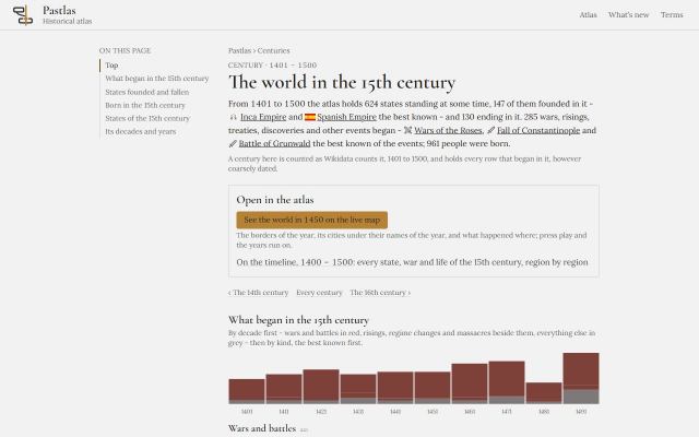
    • A page for each of the 51 centuries the atlas covers, with what began in each decade as a chart, the states founded and fallen, the best-known people born, and every state that stood, by region.
    • A page for every year in which ten or more things are dated, about a thousand of them, and for the decades between: 1206 opens on the Mongol Empire and the Delhi Sultanate, and names who held each state's highest office that year.
    • A state's page now leads from each of its centuries to the century's own page, and everything a year or a century names opens its own page or the atlas.
  37. · v2.11.0

    A war two states fought is both of theirs, and an entry with no state can be placed

    • Investigate
    • Data and accuracy

    Some three thousand entries have no state behind them, because the record does not say which, and the atlas would rather say so than guess for everyone. Now a war two states fought belongs to both, the place where something happened decides between the two states the record names, and in an investigation a reader can place an entry with no state for themselves.

    • The War of 1812 is the United States' and the United Kingdom's again, and the First Punic War Rome's and Carthage's. Every war two states fought names both, and each state's wars, charts and theories count it.
    • Where the record names two states, the place decides before fame does: Elie Wiesel is Romania's, where he was born, Sherman's march the Confederacy's, the Treaty of Nerchinsk Russia's. A battle on one state's ground is placed there, like the Battle of Muye.
    • An entry with no state offers two ways on under Conditions: place it by the border of its year, or read it by its region alone. The choice holds for that investigation only, and travels in the link.
    • The data report counts why each entry with no state has none: a continent for a place, several states at once, states that did not yet stand, no place at all, or a point outside every border.
  38. · v2.10.0

    550 more risings, coups and revolts, from Wikipedia's own lists

    • Theories
    • Data and accuracy

    The atlas held a rising only when eight Wikipedias had written it up, which left out most of the medieval and much of the modern unrest the theories ask about. Wikipedia's lists of revolutions and rebellions, of coups and of peasant revolts name hundreds more, and the atlas now holds the ones they name and says why.

    • 550 risings, coups, massacres and wars that the lists name and fewer than eight Wikipedias describe — the Stellinga of 841, the Harelle of Rouen in 1382, the Carinthian peasant revolt, the Revolt of the Pitauds, and some three hundred coups of the last two centuries.
    • Each says which list named it and that its record is thinner than most, under Where this entry comes from.
    • They are drawn where every thin row is — under Instability and at Everything — and the theories, the instability density and each state's succession now read them.
    • Argentina begins in 1861, when the Confederation's government was dissolved; the United Provinces of the Río de la Plata and the Argentine Confederation before it are states of their own, with their own presidents.
  39. · v2.9.5

    Rulers read from the articles with their dates read as dates

    • Rulers and reigns
    • Data and accuracy

    Where Wikidata names no rulers, the atlas reads them from Wikipedia's infoboxes, and it had been reading the day of a date as its year: the Song emperors were filed under an ancient Chinese state at dates before Christ, and Nabopolassar reigned to 15 BC. Dates are now read whole, an office is read as the office its holder held, and 1,383 reigns came in that had been silently lost.

    • “10 May 1278 – 19 March 1279” is 1278 to 1279, not 1278 to 19 BC; “1323/4–1362” begins in 1323, “953–77” ends in 977, and a date wrapped in markup keeps its year. Some two thousand reigns written day, month, year had been misread and then dropped.
    • The Neo-Babylonian Empire reads its six kings with their reigns, Amel-Marduk among them; Goguryeo's kings reign from their accession, not from the day they became crown prince; Gojong and Sunjong are no longer kings of an ancient Korean state, nor Andronikos I of Trebizond an emperor of Thessalonica.
    • A crown prince, a regent, a queen consort or queen mother, an emperor who had abdicated, a viceroy and a claimant hold no throne: the Duke of Zhou, David Soslan, the Maratha queens and the regent of Milan left the lines they had been read into.
    • A title a state's page happens to link is not that state's throne: thirteen rulers of the Ten Kingdoms left the Ngô dynasty, the maharanas of Udaipur left Wankaner, and the Abbasid caliphs are the Abbasid Caliphate's again. A ruler of two realms at once is drawn in both, and a reign never lands in a state that ended before it began.
    • Two reigns longer than a life are the chroniclers' own count - Suro of Geumgwan Gaya's 157 years, Niskala Wastu Kancana's 104 in Sunda - and are drawn, marked as traditional dates, and left out of every measure of how long reigns lasted.
  40. · v2.9.4

    No reign outlives its ruler

    • Rulers and reigns
    • Data and accuracy

    512 reigns in the lines of rulers ran on after the ruler's recorded death, and 165 began before the birth. Each was read against Wikidata and the rulers' articles: most were dates the record knows only to the century, read as if they were years, and the rest were reigns the record dates wrongly. None is drawn so now.

    • A death recorded only as “the 5th century BCE” is no longer read as 501 BCE. Hundreds of Roman consuls and ancient kings had been drawn as ruling after their deaths; their reigns stand, and no year of death is printed that the record does not give. Deaths it does give to the year, which those centuries had cancelled - Attila's in 453 among them - are back.
    • Wikidata gives each grand master of the Teutonic Order the reign of the master after him: Heinrich von Tunna, who died in 1209, was drawn ruling to 1239. A reign that begins in its ruler's last year or after it is not drawn; the grand master stays in the line, undated. The Order's line now dates seven grand masters, each correctly.
    • A reign recorded as running on after the death inside it keeps its start and loses the end: Zoe reigned from 1042 and died in 1050, and the 1055 on her record is Theodora's end; Sabah I of Kuwait died in 1762, not 1776. Where the record gives a ruler two deaths, the reign now agrees with the one it fits: Gorm the Old died in 964.
    • A ruler who has died is no longer drawn reigning to the present day where the record gives the reign no end, and the hover card names a ruler only up to their death.
    • Four rulers are refused by name, each with its reason: three whose record sits on the wrong person - a 17th-century bishop as the papal governor of Avignon in 1787, an Ottoman grand vizier as the emir of the Ramadanids, the legendary forefather of the Ottomans as a Seljuk sultan - and a grand master who took office forty years after the Order's state in Prussia was dissolved.
    • Some reigns lose an end that was right, because the death Wikidata records is wrong: Kanishka reigned to about 150, and Wikidata has him dead in 144. The years the record gave are kept beside every reign that changed, so nothing is lost from the data.
  41. · v2.9.3

    The lines of rulers asked again, and every change read

    • Rulers and reigns
    • Data and accuracy

    The atlas asked Wikidata again who held each state's highest office, read every line that changed against the last release, and fixed what had let the wrong people in. 230 lines changed: most gained rulers, and the rest lost ministers, deputies, governors and misreadings that had been drawn as reigns.

    • New and fuller lines: 79 kings of Champa, 27 sultans of Sennar, the beylerbeys of Ottoman Egypt from 1517 to Muhammad Ali, the kings of the Mosquito Nation, three more kings of medieval Croatia, the rulers of Negeri Sembilan, and Mahmud of Ghazni, who had been missing from his own empire.
    • A Soviet republic is ruled by its party's first secretaries. The Azerbaijan SSR's line had carried People's Commissars, deputy chairmen and ministers beside them; the chairmen of its presidium are now its formal heads of state and the chairmen of its council its government.
    • A prime minister is never a throne: Italy's, Czechoslovakia's, South Africa's and Rhodesia's prime ministers and Nazi Germany's chancellors moved from the rulers to the line of heads of government, and the chairmen of a council of ministers - Bosnia and Herzegovina's, the Ukrainian SSR's, Stalin from 1946 - are drawn there for the first time.
    • A region that changed hands is no single state's: Saladin and the Ayyubid emirs of Diyar Bakr are out of the Seljuk and the Mongol lines. A governor of Jerusalem is out of Palestine's, and a bishop out of two German princes'.
    • Where Wikidata names rulers without dates, the rulers a state's own articles date are drawn beside them, each reign once: Henry II and Richard I in the Angevin Empire, Zenobia in Palmyra, the first Bahmani sultans. A reign read as longer than a life is a misreading and is no longer drawn.
    • Five holders the record is wrong about are refused by name, each with its reason - among them a cartoon Hercules as king of Thessaly.
  42. · v2.9.2

    The line under Pastlas says what it is

    • Design and reading

    Under the atlas's name in the header, on its pages and on a phone now stands what Pastlas is - a historical atlas; who made it is still said where a reader asks, in the About panel and at the foot of every page.

    • The header, the pages and the phone read Pastlas · Historical atlas.
    • The About panel and the foot of every page still name the atlas's author.
  43. · v2.9.1

    A ruler's page shows one line, with faces, and points to the article

    • Rulers and reigns
    • Sharing and links

    The rulers' pages of the morning's release, read by the owner: one line instead of the same line twice, the time in office counted once, the faces back in the cells, and a link to the Wikipedia article on every state's and ruler's page.

    • A ruler's page shows the line the atlas files them under, with the rulers either side and their own cell in gold; the other lines they sat in are named with links, since a reign shared between two forms of one state is the same reign.
    • Time in office is the longest a ruler held one line, never the sum over lines.
    • Every cell in a line wears the ruler's face where the record has one, as the atlas draws it.
    • Every state's and ruler's page links to the Wikipedia article for the full story; the page itself keeps to what the record says.
    • Every chart's hover says what the mark is again; a fault in how the pages were drawn had left them silent.
  44. · v2.9.0

    Every state has a page of its own: its rulers, its ground, its flags and what happened within it

    • Rulers and reigns
    • Data and accuracy
    • Sharing and links

    2,283 states now have a page at an address a person can read, written from what the atlas holds about each and nothing else, so a question like who ruled Pontus or how the Kingdom of Jerusalem ended has an answer a search engine or an assistant can find and cite.

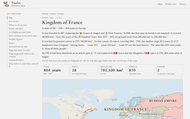
    • Each page opens on the state's dated facts and a map of it at its largest — its borders in gold among its neighbours, with the cities of that year under the names they bore then — and, where its ground changed enough, its rise and fall in three small maps of one frame.
    • Its reigns are a ribbon, each as long as it lasted and coloured by how it ended; under it the rulers in order with how each reign ended and where that is known from; then the ground it held by year, its flags and arms with their years, what the atlas records within it by century as bars, where it stands among all states, how it fell as its own article says, and the theories that apply to its ending.
    • Nothing on a page is Wikipedia's text: every sentence is the atlas's own, from its counts and its readers, and the one quoted sentence is the fact's, attributed.
    • What led to a state and what came of it, as the Investigate mode draws it: the causes and results the record names at their own years, joined to the state by the kind of claim, with the live investigation one link away.
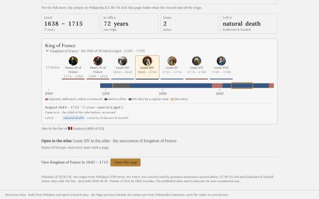
    • Every ruler a line dates has a page too — 8,360 of them — with the rulers either side and their own cell ringed in gold, the whole line as a ribbon with their reign ringed, and each reign with how it began and how it ended, in a word that names its source.
    • A list of states by region reaches every page, a list of rulers by region the best known of them, and the old name of a state merged into another still opens the state it went into.
    • A shared link to a state names its page as the one address for it, and an address keeps still whatever the name becomes.
    • Search engines are told of every address on each release.
  45. · v2.8.0

    Pastlas can be found: a page for every change, a feed, a sitemap, and a page that says what is open

    • Data and accuracy
    • Sharing and links

    The atlas used to be invisible to a search engine and to an AI assistant: every address was an empty page filled in by script, under one name whatever was open. The ground for being found is laid: real pages a crawler can read, the machine's own files, and a document that says what it holds.

    • Every change has a page of its own, so a release note can be sent and found; What’s new is readable before any script runs, and has an Atom feed.
    • A new Data page lists every file the atlas serves, what each holds and under which licence, with the counts the atlas prints about itself, read from the files at build.
    • A shared link now says what it opens: the tab and the search result read the entry’s name and years, and each entry has one address of its own.
    • A sitemap, a robots file that welcomes every crawler and AI assistant, a page for an address that is not in the atlas, and llms.txt, where a machine starts.
    • The atlas's own name is Pastlas, and its tab says so.
  46. · v2.7.0

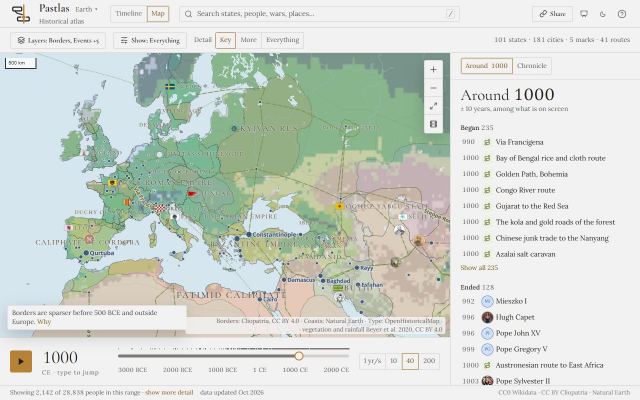
    Every territory on the map is a state, and every state has its rulers

    • Map
    • Rulers and reigns
    • Data and accuracy

    Hundreds of shapes on the map used to open only a bare card, because the atlas held no entry for them, and most states had no rulers at all. Every shape now opens a state of its own, and a state that Wikidata names no ruler of shows the rulers its English article and its rulers' articles name, with the years they give.

    • The Avar Khaganate, the Duchy of Benevento, the County of Toulouse, the Aetolian League, the Huns and some three hundred more are states of their own; where Wikidata gives them no dates, they are dated by the first and last years the map draws them, and the panel says so.
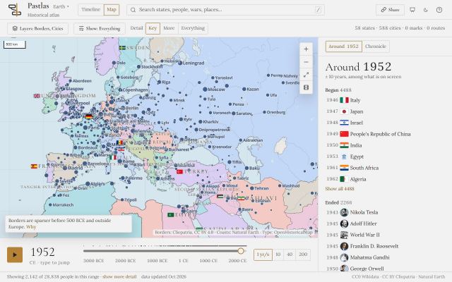
    • A shape filed under the wrong thing opens the right state: the Zaporozhian Cossacks open the Zaporozhian Sich, the title 'sultan' the Sultanate of Bone, the city of Girona the County of Barcelona.
    • A shape drawn in years its state does not cover opens the state of those years where the atlas holds one: Switzerland before 1798 is the Old Swiss Confederacy, Norway before 1397 the medieval kingdom.
    • The Kingdom of Pontus, the Bosporan Kingdom, the Latin Empire, the Khmer Empire and about a thousand other states now have their rulers, read from their articles' lists of leaders and their rulers' lines of succession, and labelled as read from the articles.
  47. · v2.6.0

    Prime ministers, party leaders, and rulers shared across one land

    • Rulers and reigns
    • Data and accuracy

    A state now shows who governed it as well as who reigned: Britain's prime ministers, the Soviet premiers and every other head of government recorded are a line of their own, drawn beside the rulers. In one-party states the rulers are the leaders of the ruling party, as each state's own list of leaders gives them, so Lenin and Stalin lead the Soviet Union and Deng Xiaoping leads China.

    • Each state's heads of government are shown under its rulers, from Walpole to the present for Britain, and a prime minister's own page shows the line with their place in it ringed in gold. They are never counted in the rulers' figures: a cabinet is not a reign.
    • In the Soviet Union, China, East Germany, Poland, Czechoslovakia, Hungary, Bulgaria, Romania, Albania, Mongolia, Afghanistan, Vietnam, Laos and Cuba the rulers are the party's leaders, read from each state's list of leaders; the formal heads of state, such as Kalinin and Voroshilov, are shown as a line of their own.
    • The British Empire now has its monarchs and its prime ministers.
    • Rulers are shared between the states that held one land in turn: West Germany has its presidents and chancellors, which the record files under today's Germany.
    • An entry for a state is now labelled State, and a border on the map that opens no entry yet is labelled Territory.
  48. · v2.5.1

    Ukraine in 1918 is Ukraine, not Germany

    • Map
    • Data and accuracy

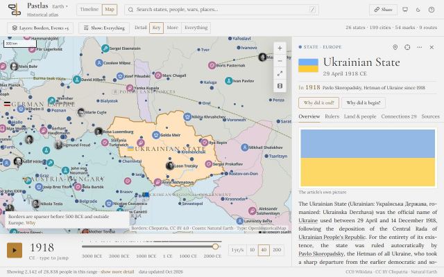
    The map of 1918 drew Ukraine as part of the German Empire, because the borders dataset draws the land the Central Powers occupied after the Treaty of Brest-Litovsk as Germany's own. The Ukrainian State of Hetman Pavlo Skoropadsky was Germany's ally under occupation, never a part of it, and the map now draws it as a state of its own.

    • In 1918 Ukraine is drawn as the Ukrainian State, from Volhynia to Kharkiv and from Chernihiv to the Black Sea, and Germany ends where Ukraine begins; Crimea is drawn as the Crimean Regional Government that governed it that year.
    • The Ukrainian People's Republic now begins with the Third Universal of November 1917 rather than in December 1918, so the months of the Central Rada, the Fourth Universal and the Battle of Kruty have a state of their own; its panel says that the Ukrainian State governed in its place from April to December 1918.
    • Events of 1918 on Ukrainian ground belong to whichever state stood on their own day: the Ukrainian People's Republic before 29 April and after 14 December, the Ukrainian State between.
    • In 1919 the map's Ukraine opens the Ukrainian People's Republic.
    • State names on the map from 1960 on are sized and placed by their own territory again: since the last release some had been read against a neighbour's.
  49. · v2.5.0

    Nearly twice as many states, and the rulers who headed them

    • Map
    • Rulers and reigns
    • Data and accuracy

    The atlas now holds every state its own articles link to that Wikipedia writes up in five languages or more - from the Kingdom of Sardinia and Afsharid Iran to the Chola Empire, the Neo-Inca State and Tiwanaku - each dated, placed and given its flag as every other state is. Their rulers came with them: anyone who headed a state of the atlas and has an article in five languages is now an entry of their own.

    • About 1,470 states joined, among them the Savoyard Kingdom of Sardinia, Nanyue, the Ghurids, the Burgundian State and dozens of Indian princely states; they carry their flag or arms where the record holds one, and 240 of them have their ground measured from the borders dataset.
    • A new state the map draws from its own borders, but whose record gives it no place, is filed in the region where those borders lie rather than under Location unknown, and its panel says so.
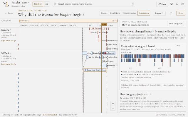
    • The Kingdom of Poland is one entry, not two, and what happened inside its borders belongs to the kingdom of the year: the Piast kingdom to 1385, the Jagiellonian after. The Ahom dynasty and the Ahom kingdom are likewise one.
    • Events and people inside the new states are now theirs: the Battle of Badr belongs to the first Islamic state at Medina rather than to a Nubian kingdom, and the battles of Sekigahara and Nagashino to Japan rather than Korea. Where the atlas has only a guess, it still says it is a guess.
    • About 2,200 more rulers are entries of their own, hosted by the state they ruled, with how they died, their families and their portraits where the record holds them; 1,113 states now have a line of rulers, where 823 did.
    • England's overseas possessions now run to 1707, when they became the British Empire's; they had been drawn as a single year.
    • Every change in a country's form of rule now begins a new entry, as it already did for India and Italy: Ghana is the Dominion of Ghana until the republic of 1960, Cuba the Republic of Cuba until 1959, and Burma the Union of Burma, then the Socialist Republic, then Myanmar after the coup of 1988 - on the timeline and on the map. Occupations and rival governments are drawn beside the state they claimed.
    • The Slavic tribes' lands are now in the Tribes & ethnic groups layer with the other peoples rather than among the states' borders, and a tribe is never offered as the nearest state to an event.
    • Crimea is shown as part of Ukraine in every year. The borders dataset drew it inside Russia from 2014; the map, and everything the atlas places by borders, now follow Ukraine's internationally recognised borders, and an event in Crimea or in the regions occupied since 2022 belongs to Ukraine, whatever country the record gives it.
    • Clicking a territory on the map never opens a person or an event any more: where the borders dataset filed the land under a ruler, it opens the state that ruler held, or a card that names the ruler and opens the entry.
    • A territory the atlas holds no entry for in those years no longer shows a made-up history of when its borders were mapped: it says which entry the land is filed under and opens it - Poland's borders now open Mieszko's Civitas Schinesghe, the Piast kingdom or the Jagiellonian one, by the year.
    • People are in the atlas for ruling, or for working in a field history records - politics, war, religion, nobility, culture, science. Culture means what a person made: performers - singers, actors, dancers - however famous, athletes and businessmen are no longer on the map, while a composer who also sang, like Artemy Vedel, stays. Nobody is filed under politics for want of a profession.
    • Detail - Key, More, Everything - now thins the map as it thins the timeline: Key shows the best-known people and events of the year, Everything all of them.
    • Everyone who headed a state is filed as a ruler, whatever else they were: Mykhailo Hrushevsky, head of the Ukrainian People's Republic, no longer reads as a politician.
    • On the timeline a person's portrait sits on the start of their lifeline again, rather than hanging below it.
  50. · v2.4.0

    Every ruler in every line, and Compare cases in plain words

    • Investigate
    • Rulers and reigns
    • Design and reading

    Lines of rulers are now whole and shared between the forms of one state: Babylonia has its kings, the Old and Middle Kingdom of Egypt their pharaohs, the Roman Republic its consuls, and Ancient Rome its kings, consuls and emperors together. A ruler's own page shows the line they belonged to, with their place in it ringed in gold and how their reign began and ended. Compare cases now reads as plain questions answered in words, under the names of the cases, and Pastlas wears its own mark.

    • Lines are no longer cut short: all 516 pharaohs Wikidata records are in Ancient Egypt's line where 120 were, and every hetman of the Zaporizhian Host is in the line of the Sich he led - Sahaidachny, Kosynsky, Nalyvaiko - while the Cossack Hetmanate's line starts with its own hetmans in 1648.
    • A ruler appears under every form of the state they ruled: Romulus in the Roman Kingdom and in Ancient Rome, a pharaoh in Ancient Egypt and in its Old Kingdom, the kings of Babylon in Babylonia. A line read from another form of the state says so.
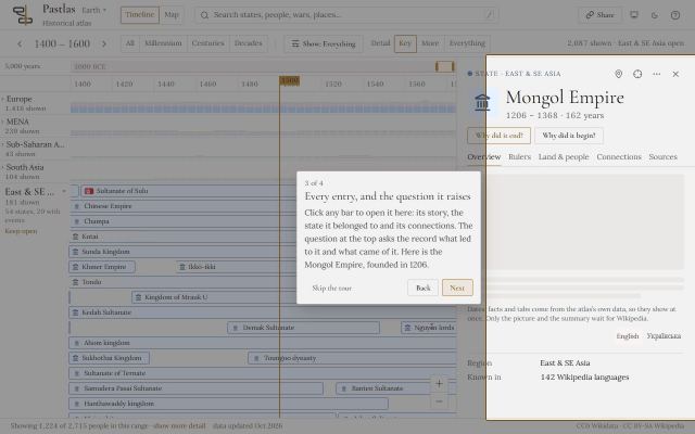
    • Ancient Carthage keeps its kings, and the Roman Republic's consuls, two a year, are shown together and never counted as rival claimants; the same goes for San Marino's Captains Regent, the Swiss Federal Council and Andorra's co-princes.
    • A ruler's page shows each line they held, their own place ringed in gold among the rulers before and after them, and how they came to power and how their reign ended, each as a coloured label with where the atlas read it.
    • Cases side by side asks plain questions - wars under way, risings in the years before, drought, eruptions, ground gained or lost - and answers each in words; the columns carry the cases' names, an i beside each question names its source and the theories that read it, and a search box adds any entry as a case, offering the closest like cases first.
    • Pastlas has its own mark: the header, the site's pages, the About panel and the browser tab now carry it, in the colours of whichever theme you read in.
  51. · v2.3.1

    Cities read as themselves, not the provinces named for them

    • Map
    • Cities and places
    • Data and accuracy

    Each city on the map is matched to its record by name, and where a province, a state or a building shared the name and was better known, the city read that instead - its article, its founding, even its end. The match now always prefers the city, and the population table's own misplacements are corrected one by one, each with its reason.

    • Akita, Kursk, Oaxaca, Sokoto, Hamadan, Banda and some eighty more cities read their own article rather than their prefecture's, oblast's, state's, province's or district's, and Chihuahua, Indianapolis and Providence no longer begin in the year their state was made.
    • Berlin no longer ends in 1950: it had been read as the Berlin Palace, demolished that year. Singapore, Bucharest, Bangkok, Pyongyang, Ulaanbaatar and Ugarit read their own articles where they had read a hospital, a railway station, a hotel, a military university, a book fair and an alphabet.
    • Khersones - Chersonesus, the Byzantine city by Sevastopol that the Rus' chronicles call Korsun - is on the map from its founding to its last mention in 1396, with the population of 800 and 1000 that had been drawn at Kherson; Kherson stands from its founding in 1778.
    • Yekaterinburg carries Soviet Sverdlovsk's population of 1950 and 1975, which had been drawn at the small Ukrainian town of the same name.
    • Thirteen cities the population table had put at the middle of their province, or on another town, stand where they were: Old Goa, Old Banten, Mrauk U, Kilwa Kisiwani, Birnin Kebbi, Jilin City, Bihar Sharif, Dharwad, and Isanapura, Pundravardhana, Anbar, Bobastro and Vijaya at their ruins.
    • Portland, Maine, and Springfield, Massachusetts and Illinois, read their own articles; each had read a namesake's.
  52. · v2.3.0

    The actors of Ukrainian history, and many more rulers

    • Rulers and reigns
    • Names and languages
    • Data and accuracy

    The atlas used to hold a person only if eighty or more Wikipedias wrote about them, which kept out almost everyone who mattered most to one country's history and was written up mainly in its own language. It now also holds every head of state its lines of rulers name, everyone the articles of its states and events keep naming, the living, and - by name - the actors of Ukrainian history: the hetmans from Sahaidachny to Rozumovsky, the princes of Kyiv and Halych, the leaders of the Ukrainian People's Republic, and its writers, composers, scholars and clergy. The Cossack Hetmanate and the Zaporizhian Sich are states on the timeline and the map, and the Hetmanate's hetmans belong to the state they ruled.

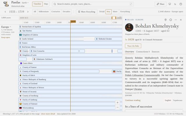
    • Bohdan Khmelnytsky, Petro Doroshenko, Ivan Mazepa and Petro Konashevych-Sahaidachny open from search and from the timeline. Khmelnytsky, Doroshenko and Mazepa are placed with the Hetmanate they led rather than with the Commonwealth on their papers; Sahaidachny, who died before the Hetmanate was founded, still reads the Commonwealth.
    • Hryhorii Skovoroda, Ivan Kotliarevsky, Marko Vovchok, Mykola Lysenko, Dmytro Bortniansky, Artemy Vedel and hundreds more are in the atlas: people who were citizens of a Ukrainian state, were born or worked in Ukraine, or wrote in Ukrainian.
    • Living people are in the atlas, and read as living - their panel says there is no death on record, and their span runs to the present.
    • Far more states now have a line of rulers for Succession: the Ming, the Qing, the Han and the Tang have their emperors, Assyria and Babylon their kings, the Safavids their shahs, the Gupta Empire its emperors. The rulers are read from every place the record keeps them - the office, the term that names the dynasty, the state's own list of its heads, a title, a family.
    • Japan's line includes Hirohito again: a reign now counts where it overlaps a state's years, not only where it began inside them.
    • Ukrainian cities on the map are spelled as Ukrainians spell them - Kryvyi Rih, Bilhorod-Dnistrovskyi, Bakhchysarai, Nizhyn, Mykolaiv, Zaporizhzhia - and carry the name of each year: Katerynoslav, Dnipropetrovsk and, since 2016, Dnipro; Yelysavethrad, Kirovohrad and Kropyvnytskyi; Khadzhybei before Odesa; Stanyslaviv before Ivano-Frankivsk.
  53. · v2.2.0

    Every page of an investigation says how to read it

    • Investigate
    • Theories
    • Design and reading

    Causes, Conditions, Succession and each tab of Compare cases now open on a guide of their own: what the page is for, what its words and marks mean, which number to look at first, and the one thing not to conclude from it. Theories has been set again from the top, as a printed atlas sets a spread - a headline, a tally of the five verdicts in large figures, and each theory that applies in three columns: its argument and the main objection, its conditions one by one, and how often its outcome follows them.

    • A guide opens the first time you reach a page and then stays as you leave it, on your device. In the narrow rail it is an index of numbered topics that open one at a time, so the answer you came for is still on the first screen; in Compare cases it is set in columns.
    • Theories says plainly what each of its five verdicts means - applies, close, absent, cannot be checked, does not ask - and counts the theories under each before any detail.
    • Each theory that applies shows whether every condition it names held here, the rows behind each, and its rate as two large figures, with the conditions and without, saying whether they are read for the region or across the atlas.
    • The near-fits are cards side by side that name the missing condition before they are opened; a state's own history reads as a table with each theory's share of its risings drawn as a bar; and the library below is set at reading sizes.
    • The headings of Compare cases are set in the display face at the design's sizes, and its notes and tables a step larger.
  54. · v2.1.2

    Events placed in the state whose land they happened on

    • Investigate
    • Data and accuracy

    Where the atlas places an event, a person or a natural disaster in a state by the historical borders, it now reads only that state's own land, as the map has since the last release. Land the borders dataset files under one state because two states were bound by an alliance or an allegiance no longer makes the first of them the host, and a state's dependencies count as its land only in a year the dataset draws none of its own.

    • The Tumu Crisis of 1449 is the Ming's rather than Joseon's, the Battle of Ankara the Timurids' rather than Georgia's, the first Muslim conquest of Jerusalem the Byzantine Empire's rather than the Sasanians', the Battle of Morgarten the Holy Roman Empire's rather than Bohemia's, and the London Beer Flood of 1814 the United Kingdom's rather than the Hawaiian Kingdom's.
    • Where two states' lands overlap, the smaller is read first, so the North Sea flood of 1962 is West Germany's and the Berlin Crisis of 1961 East Germany's, where both had been read as an occupying power's.
    • People and events in Britain belong to the British state of their year - the Kingdom of Great Britain, the United Kingdom of Great Britain and Ireland, then the United Kingdom - rather than to the British Empire; Jane Austen is the first's and Winston Churchill the second's.
    • About 380 entries name a different host state, and the theories and the measures of unstable successions that read a state's conditions were worked out again. Earthquakes, eruptions and tsunamis from the hazard catalogue are placed the same way, and none is placed in an alliance's land any more.
  55. · v2.1.0

    The Slavic tribes on the map

    • Map

    The Antes, the Sclaveni and the East Slavic tribes of the chronicle now have ground on the map in their own years: the Polianians between the Irpin and the Ros, the Derevlianians in the forests of Polissia, the Krivichs on the upper Dnieper and the Dvina, the Vyatichi on the Oka, and the rest. Their borders are approximate - nobody ever drew one - so they are dotted, traced along the rivers their sources name and set against a map of the East Slavic tribes.

    • Before a state's border reaches them, a people is drawn as ground of its own, in a tint no neighbour shares; once a state's border holds them - Kyivan Rus' from the 880s - they are a dotted outline with their name inside it, a people of that state.
    • Hover a people's ground for its card, click it to open its entry; its Sources say how its ground was drawn and against which map.
    • In the sixth century the Antes and the Sclaveni stand where the later tribes will, and the tribes take their ground as they leave the record.
  56. · v2.0.0

    A new look: the atlas set like a printed one, in light or dark

    • Timeline
    • Map
    • Investigate
    • Design and reading

    The whole atlas has been redesigned. It reads like a printed atlas now: a serif for names and headings, a quiet paper in light and the navy of the atlas's home page in dark, one gold for whatever you chose, and six inks for politics, conflict, nature, culture, science and trade. Every bar, row and mark shows what it is at a glance - a state's flag for the year, a person's face, an event's picture, or the kind of thing it is as an icon - and the map stands on a plain plate of land and sea with the states named and flagged as an atlas names them.

    • Two rows of controls instead of five. The header holds the view, search, sharing and help; the toolbar holds the range, the zoom, Show - every topic and kind of thing in one panel, with what is drawn against what is held - and how much detail to draw.
    • On the timeline, a state's bar wears its flag, a life its face, and every other bar the icon of its kind. The rail beside it reads "In 1550": what was standing, happening and alive in the year, best known first.
    • An entry opens on what it is - its name, its years, what was true of it in the year on screen - with the question it raises as a button: why did it end, why did it begin, why did it happen. The rest is in tabs: an overview, its rulers, its land and people, its connections, and the sources for every fact.
    • Investigate asks its question in words - "Why did the Peasants' Revolt happen?" - and answers first, in one sentence, before listing the causes by the part they played, each with how strong its evidence is. The theories whose conditions held are listed under the causes, one line each; Compare cases now takes the whole width, with the theories, a cause removed and the patterns in the record in tabs of their own.
    • The map no longer stands on a street map of today. It is a plain plate of land, lakes and rivers, with each state in a soft tint of its own, named in capitals with the flag it flew that year. Every layer, the ground and the relief are in one Layers menu that says which of them reach the year on screen, and the rail beside the map reads what began and ended around it.
    • On a phone the atlas no longer asks for a wider screen: the timeline reads century by century for one region, an entry opens as a sheet, and the map and search are a tab away.
    • A first visit offers a four-step tour rather than starting one, and the lane for things no place was found for is now called Location unknown.
    • Every chart answers a hover: a bar, a century, a reign or a point on a line says what it is and what it counts, beside the pointer.
    • A state the record held twice is one state now: Carthage and Ancient Carthage, and seven empires that stood beside their own dynasties - the Abbasids, Achaemenids, Sasanians, Seleucids, Ptolemies, Seljuks and Samanids. The Seleucid Empire now has its borders on the map, and an old link to the second record opens the state.
    • Different states that share a name are told apart by their years, as their articles are: the Kingdom of Hungary and the Kingdom of Hungary (1526–1867), the Jin dynasty (266–420) and (1115–1234).
    • A person belongs to the state they were born or worked in, never to the nearest one: Xenophanes and Pythagoras were filed under Troy and are Ancient Greece's, and Gandhi is the British Raj's. Someone born where no border is recorded is left without a state rather than given a wrong one.
    • With a picture of the ground or the relief on, the states keep their colours; the flags no longer blink as the cursor moves; Show on the map always flies there; and the atlas's name is followed by its author's.
  57. · v1.9.0

    A second world beside the Earth, and modern states dated from their own beginnings

    • Map
    • Rulers and reigns
    • Data and accuracy

    The atlas now opens on a second world, the history of Tolkien's Middle-earth from the Years of the Trees to the end of the Third Age, built with the same timeline, map and reading as the Earth. And on the Earth, a modern state no longer stretches back across the kingdoms and empires that came before it: each begins where its own history does, and the events of earlier centuries belong to the states that stood when they happened.

    • The second world, beside the atlas's name: the annals of the First, Second and Third Ages, every realm drawn on a map grown from the text and from freely licensed sketch maps, each person where the record puts them in the year on screen. An unofficial, non-commercial fan project; its text comes from the fans' wiki under CC BY-SA, and the books are cited by chapter, never reproduced.
    • Twenty-nine present-day states are dated from their own beginnings: Russia from 1991, Japan from 1947, Germany from 1990, Italy from 1946, Poland, Hungary and Romania from 1989, Ukraine and Georgia from 1991, Portugal from 1910, Brazil from 1889, and more. The kingdoms, empires and republics before them were already drawn as states of their own; now the events of their centuries are theirs too, so the Battle of Kulikovo belongs to Muscovy and Lomonosov to the Tsardom of Russia.
    • France keeps its long span as the country, and every event filed under it now belongs to the French state of its day, from Francia to the Fifth Republic; the Battle of France in May 1940 is the Third Republic's.
    • Seventeen states keep their span, because what they seemed to swallow was a regime, a rival claim or an occupation inside one continuing state: the United States beside the Confederacy, Mexico beside its First Empire, Estonia and Latvia under Soviet occupation.
    • The counts of titled people and office-holders follow those Wikidata files under a modern country back to the kingdoms they lived in: the Kingdom of Hungary, the Polish Crown and Commonwealth, the shogunates of Japan.
    • The atlas's code is licensed under the GPL, version 3, and the atlas is a non-commercial project; the About panel says so beside the data's own licences.
  58. · v1.8.0

    Peoples on the move, the ancient world's places, and a record that agrees with itself

    • Map
    • Investigate
    • Cities and places
    • Data and accuracy

    The map now draws the movements of peoples while they were under way and, when asked, the towns, forts and shrines of the ancient world in the periods each is attested in. Underneath, a week of repairs: the reader of article sentences stopped mistaking words for causes, a few rows filed as the wrong kind of thing were put right, and every number the atlas's own documents print is now checked against the data it comes from.

    • Migrations on the map: each movement drawn only in its own years, as a line with arrows from where it began to where it arrived, a ring at its start and the people's name, the dash saying how well it is attested. In 400 the Huns are crossing from the steppe towards the Hungarian plain and the Visigoths from the Danube towards Toulouse. Nothing slides along the line with the year: two endpoints do not say where a people was in between.
    • Ancient places: the settlements, forts and shrines the Pleiades gazetteer locates and dates, nearly sixteen thousand of them, each drawn in the periods it is attested in. Off by default, because it is dense; switch it on beside the cities.
    • The map's layer switches wrap between switches rather than inside their names, and one that is off can be read over the map.
    • Investigate reads an article's sentences more carefully: “fled to” and “failed to” are no longer read as “led to”, nor “Following their” as “following the”, and a sentence that names its subject by a word of its name now counts as that subject's. About sixty causes that were never in the text went, and the pandemic pages now name the virus that caused them.
    • A bacterium is not dated by the year it was identified: Yersinia pestis is no longer drawn as a discovery of 1894 that caused plagues centuries earlier; the plagues keep it as their cause, undated. Laki in 1783 is an eruption rather than a discovery.
    • An earthquake, a wave or an eruption the atlas already draws is no longer drawn a second time from the NOAA catalogue — Tambora's wave of 1815, the shock under Thera, Vesuvius in 1631.
    • Background data reads four records over all the years they hold, not the narrower years once typed for them, and Denmark and the medieval Kingdom of Norway now read the people Wikidata files under their other names.
    • Where the atlas prints a Ukrainian form of a name, the panel now says whether the other name beside it is Wikidata's label or the English article's title.
  59. · v1.7.0

    The ground under the map through time, the map in 3D, and charts where there were sentences

    • Map
    • Theories
    • Rulers and reigns
    • Design and reading

    The map can now show what the ground was like, not only who held it: how people used the land at every step from 3000 BCE, what the climate of each millennium let grow, how much rain fell against today, and how warm it was against the twentieth century — each a model or a reconstruction that says which, and at which step. The relief can be shaded or tilted into 3D. And every chart in the atlas is now a bordered card of its own, with new ones where the panels used to say it in sentences.

    • A Ground & climate panel on the map. Land use (HYDE 3.2.1): settlements, villages, croplands and rangelands at every step from 3000 BCE, fading from one step to the next as the year moves — in 3000 BCE the farmed land is a thread along the Tigris, the Euphrates and the Nile and almost nowhere else. Vegetation and rainfall (Beyer, Krapp & Manica 2020), every thousand years: the Sahara and Arabia read wetter than today at the start of the atlas, the tail of the green Sahara.
    • Temperature against the twentieth century: the regional reconstructions of the PAGES 2k Consortium inside the regions they cover — Europe a cold blue through the Little Ice Age — and the Holocene latitude bands of Kaufman et al. everywhere else, one source per place, each named on hover. A chart of temperature through time with the climate episodes the literature names, from the 4.2 kiloyear event to the Maunder Minimum, each with its works.
    • Where farming began: the eleven independent centres of domestication, from the Fertile Crescent to eastern North America, each with what was domesticated there, when, and the studies that date it.
    • Relief: shaded, or the map tilted into 3D over today’s terrain, so the Zagros stand behind Mesopotamia and the Alps behind Venice.
    • Every chart is now a bordered card with what it shows, what it is drawn against, an “i”, its source, and its numbers as a table one click away.
    • New in a state’s panel: the ground it held and the city at its seat over its whole span, with its wars and risings marked; where it stands among all states five ways, each counted only over the states that carry the measure; and another state of your choosing aligned at the founding of each.
    • The reign ribbon: every reign as long as it lasted, coloured by how it ended, wearing the ruler’s face, each one opening the ruler.
    • Each theory’s rates as a chart — with its conditions, without, and the control — by century and by region.
    • The faces of a year, from the status bar: everyone alive at the cursor, grouped by state, with their age that year. And What is here: the window as a treemap of regions, families and kinds, each cell opening its region with that family alone.
    • The chronicle wears the flag a state flew, a person’s face or the kind’s sign on every row, with a heading per century, and can sit beside the timeline in place of the list at the cursor.
    • What’s new can be read by date, by topic and by words, and a filtered view of it can be sent as a link.
  60. · v1.6.1

    Every city joined to its record

    • Map
    • Cities and places
    • Data and accuracy

    The cities on the map now carry what Wikidata knows of each: 1,528 of the 1,588 are joined to their item, 744 with a founding on record, 32 with an end, and the card opens the city's article.

    • A city's card now gives its founding where Wikidata records one earlier than the first population estimate — Rome from 753 BCE, Ur from the fourth millennium — and its abandonment where one is recorded, with the article under it.
    • The join prefers the city to anything that shares its name — Mexico City is no longer its metro, Córdoba not its province — and the handful the name alone could not place (Ur, Toledo in Ohio, Ani, Mayapan) are joined by hand with the reason written down.
    • The table's Memphis carried Memphis, Tennessee's population of 1975 beside the pharaohs'; the Egyptian city now ends in 641.
  61. · v1.6.0

    Cities on the map in their own years, and the atlas reads the articles: how each ruler left office, how each rising ended, how each state fell

    • Map
    • Rulers and reigns
    • Cities and places
    • Names and languages

    Wikidata knows how 29 of the 3,102 rulers who left office alive left it. Their own Wikipedia articles say, in prose, and the atlas now reads that prose by one rule: a sentence counts only when its grammar makes the page's subject its subject — “Peter III was deposed” counts, “Childeric II was killed” on his successor's page does not. The same reader gives every war, battle, rising and coup its outcome and every fallen state its ending, each with the sentence it was read from. More events have a host state, and Wikidata's own end-of-term cause is read where it exists.

    • Cities on the map, drawn only while they stood and under the name they bore in the year on screen: Constantinople in 500, Istanbul in 1950, no Rome in 1500 BCE. 1,597 cities with population estimates from 2250 BCE to 1975 CE (Chandler's and Modelski's tables as digitised by Reba, Reitsma & Seto, 2016), each dot sized by the estimate for the year, with a card giving when it stood, what it was called in each period, and how many lived there at each of its years. A new “Cities” chip; it travels in the link.
    • Every entry is named as its Wikipedia article is. Wikidata's label and the article's title disagreed for some 2,900 entries — “Long War” for the Long Turkish War, “Coalition Wars” for the French Revolutionary and Napoleonic Wars, “Ifat Sultanate” for the Sultanate of Ifat — and the article's name now stands on the timeline, the map, the search and the panel alike. The atlas's own Ukrainian names still come first, and a bare word the fuller name qualifies keeps it: the People's Republic of China is not “China”, because every “China” in every article would then be the state of 1949.
    • The map's name for a state is the atlas entry's, which is its Wikipedia article's, wherever the border polygon is that entry alive in those years — “Kingdom of Galicia–Volhynia” where the borders dataset wrote “Halych-Volhynia occupation” — and the card still says what the dataset called it.
    • Every reign on a succession line now says how it ended as the ruler's own article tells it — deposed, abdicated, resigned, killed, executed, exiled, lost an election, served out the term — with the sentence printed under the reign and “read from the ruler's own article” as its source. It decides a reign only where a historian's coding, Wikidata's end cause and Wikidata's manner of death all say nothing, which is most rulers who left office alive.
    • Two more grounds for an irregular handover: the ruler's own article says they were deposed, exiled, killed or executed, and the successor's own article says they seized power. The Russian Empire's palace revolutions and a Mughal emperor's deposition now count where the record alone could not see them.
    • What a war, battle, rising or coup came to, as its own article says — put down by whom, a victory for whom, settled by which treaty, succeeded, not over — in the reading at the top of the investigation and on the hover card, for 481 events; and how a state fell — conquered by whom, partitioned, dissolved, replaced by what — for 235 states. Each with its sentence; nothing is said where the article's words could not be tied to the subject.
    • Wikidata's own end-of-term cause (resignation, abdication, deposition, a coup, a named event such as the Glorious Revolution) is read for the 214 terms that carry it, above the manner of death: a term that ended by abdication did not end by the death years later.
    • 888 more events have a host state: the border test now reads the point of the city, region or battlefield an event names, not only an event's own coordinate. Fewer risings, regime changes and massacres stand without a state for the theories to read.
    • Download of the reign table carries the new columns: Wikidata's end cause, the article's word and its sentence, and the successor's seizure.
  62. · v1.5.0

    Rulers with faces, successions in the open, theories over a state's whole history, and an “i” on every block

    • Investigate
    • Theories
    • Rulers and reigns
    • Design and reading

    A state's investigation now shows its succession at the top — every reign on the calendar, the rulers in order as portraits, and how many handovers were irregular — rather than behind a mode. Every ruler named anywhere wears their picture, opens their entry and answers the hover card. The theories are read over the events of a state's own history, every block explains itself on request, and tables of numbers are drawn as bars.

    • How power changed hands, in the reading itself: the reign strip coloured by how each reign ended, the rulers in order as faces, and the irregular handovers counted — a killing, an execution, a death in battle, a coded deposition, a violent death within a year of leaving, a rival already reigning, a rising beside it or a coup. “Died in office” includes a tsar strangled in his bedroom, and the violent share is printed beside it.
    • Every mention of a ruler — in the reading, the reign list, the rows of the rail — shows their portrait where Wikimedia Commons has one (5,276 of the 6,394 rulers on the lines), opens their entry on a click, and shows the card on hover, including rulers the atlas holds no entry of its own for.
    • The theories are read over a state's own history: for each theory, how many of the risings, regime changes, massacres and wars the atlas records under the state it applies to, and which — so the Byzantine Empire no longer reads as a state no theory has anything to say about.
    • A way back: a “Back to the investigation” button at the top of the Succession, Background data and Compare cases panels.
    • An “i” beside every block of the investigation, opening two or three sentences on what the block is and how to read it.
    • Tables of numbers — how the reigns ended, the line by century — are drawn as bars with the count, the share and the source on hover; the columns are one click away.
  63. · v1.4.0

    Investigate, rewritten to read: the subject in its own terms, theories judged by their own logic, and every reign with the reason it ended

    • Investigate
    • Theories
    • Rulers and reigns
    • Data and accuracy

    The Investigate rail now opens on what the subject is — a state's span, origin, body and end; an event's kind and parts; a person's offices, wars and family — before it lists the links, and every link says what it is. Theories are judged condition by condition. A new Succession mode reads every reign with how it ended and where that is known from. Ninety states that flew no flag now show the seal, arms or clan mark their article does.

    • The Investigate rail opens on a reading of the subject: a state stood so many years, came after these states and was followed by those, holds this many wars, risings and people, drew this much ground, changed rulers this often, and ended among these events — every name a link, every bar and line a way to move the plot to the years it counts. Click a century to see what the atlas holds in it.
    • Every link says what it is. A predecessor state, a battle in a war or a ruler's father used to read as a “long-term cause · weak”; it now reads as the relation the record made, and says it is not a cause. Long lists are grouped by what the links are — “Took part in · 36”, “Family · 9” — with the largest group open.
    • Theories are judged by their own logic, condition by condition: which of the conditions a theory names held here, which were absent, and which could not be measured, with the rows behind each. Theories that come close — some conditions held, not enough — are shown with what was missing. Whether the authors wrote about the case is a footnote, never the verdict.
    • What says nothing is out of the way: measurements that could not run, the names in the article and the links set aside are behind a click, with their counts on the label.
    • A Succession mode in Investigate, for any state with a line of rulers: every reign with its dates, the ruler's age, how the reign ended — died in office, killed, executed, in battle, left alive, deposed as coded — and the source of that reason: Wikidata's manner of death, Kokkonen & Sundell's coding for 27 European monarchies, or the dates alone.
    • Who followed whom: for every handover, whether the successor was the predecessor's child, sibling, spouse or other recorded kin. Where nothing is recorded it says so, never "unrelated".
    • The numbers beside the list: median reign and its spread, a survival curve against the atlas as a whole, age at accession, interregna and rival claimants, the risings beside a handover by name, and the same by century.
    • Download the reign table as CSV, with every ending and its source.
    • Ninety states that flew no flag — the Mongols, the Ming, the Sasanians, the Achaemenids — now show the symbol their article does: a seal, a standard, a coat of arms, a clan mark or a coin, named as what it is. 1,098 of the atlas's 1,522 states now carry a symbol.
  64. · v1.3.0

    Nearly every event on the map, real dates, period flags, and a light theme

    • Timeline
    • Map
    • Data and accuracy
    • Design and reading

    Nine in ten events now have a place on the map, event dates follow one clear rule, states show the flag they flew in the year you are reading, and the atlas comes in a light theme and a deep navy dark one.

    • Events with no coordinate of their own are now marked at the place they happened, drawn fainter over a ring so you can tell. Nine in ten events appear on the map, up from about half.
    • Event dates are now chosen by one rule instead of by chance. The American Civil War reads 1861–1865 (it read 1865), the Great Northern War 1700–1721, and treaties sit at their signing. About two hundred events changed, and the Wars of the Roses, the Suez Crisis and others that had gone missing are back.
    • Where Wikidata's only date for an event is plainly wrong, the atlas follows the event's own article and says so beside the dates: the Phoney War ran from September 1939 to May 1940, not until 1958.
    • States on the timeline, in the list at the cursor and in the preview card show the flag or coat of arms they flew in the year on screen, credited to Wikimedia Commons.
    • A light theme, and a dark theme in deep navy. The switch is in the header; until you choose, the atlas follows your system setting.
  65. · v1.2.1

    Events that crossed borders belong to no single state

    • Investigate
    • Theories
    • Cities and places
    • Data and accuracy

    A pandemic, a world war or an earthquake felt in several countries is no longer filed under one of them.

    • The Black Death was shown as Georgia’s, and Investigate read Georgia’s wars and rulers as its conditions. It now belongs to no single state, as do COVID-19, the Holocaust, the Second World War and about a hundred other events that crossed borders.
    • Where such an event has a place of its own, the border at that place decides: the Nepal earthquake of 2015 is now Nepal’s rather than India’s, and the Haiti cholera outbreak Haiti’s rather than Mexico’s.
    • Some theories of history no longer apply to cases they had been reading through the wrong state.
  66. · v1.2.0

    A guided tour, and Investigate easier to read

    • Investigate
    • Theories
    • Design and reading

    First-time visitors get a short tour, Investigate is easier to read, and this page lists everything that has changed.

    • A short guided tour on your first visit. Skip it at any time, and replay it from the How to page.
    • Larger text in the Investigate panel, which you can now resize.
    • The theories section now shows first the theories whose conditions fit the case; the rest are behind “Show all”.
    • This page: what has changed, newest first.
  67. · v1.1.0

    A home of its own

    • Sharing and links

    The atlas now lives at the root of its own address, https://app.pastlas.com.

    • New address: https://app.pastlas.com. Every view you share now starts there.
    • Visits are now counted anonymously, without cookies and without anything you type, and Do Not Track is respected. The About panel says so.
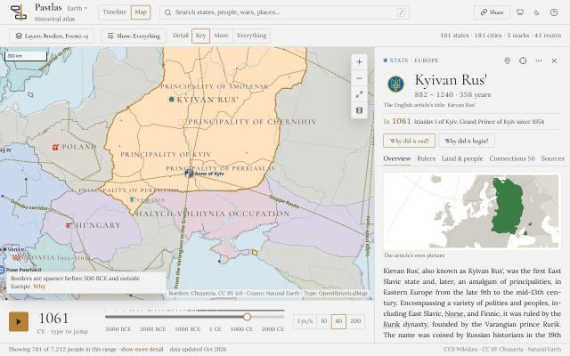
  68. · v1.0.0

    The atlas is public

    • Timeline
    • Map
    • Investigate
    • Sharing and links

    The first public release, open to everyone, with no account and nothing to install.

    • About 16,000 states, events, people and works from Wikidata, from 3000 BCE to 2025, on one timeline and one map.
    • Borders that change with the year, 184 trade corridors, Roman roads, ancient peoples, and NOAA’s record of 10,726 eruptions, earthquakes and tsunamis.
    • Every entry opens its Wikipedia article inside the atlas, in English or Ukrainian.
    • Investigate any entry: what led to it and what came of it, with the evidence behind each link, and which of eleven theories of instability fit the case.
    • A How to guide in English and Ukrainian, and every view shareable as a link.
    • Designed for a desktop screen; on a phone it offers the map and search.
  69. · v1.0.0

    Kyiv, not Kiev, and the peoples of the steppe

    • Investigate
    • Cities and places
    • Names and languages
    • Data and accuracy

    Ukrainian places and the princes of Kyiv are now named the Ukrainian way, and the Scythians, the Sarmatians and the East Slavic tribes have entries of their own.

    • Ukrainian place names are now spelled the Ukrainian way: Kyiv, Chernihiv, Kharkiv, Lviv, Odesa, the Dnipro. The princes of Kyiv are named as Ukrainian historiography names them: Volodymyr the Great, Ihor of Kyiv, Danylo of Halych. More than 200 names changed.
    • Quotations and article titles keep the spelling their authors used, and where a name differs the panel also shows Wikidata’s English label.
    • Search finds either spelling: typing “Kiev” finds Kyivan Rus’.
    • Kyivan Rus’ now flies the trident of Volodymyr the Great on the map, as struck on his coins, from his accession in 980.
    • Twenty-one peoples that Wikidata records without a date or a place are now entries, read from their Ukrainian Wikipedia articles: the Cimmerians, Scythians, Tauri, Sarmatians, Antes and Sclaveni, and fifteen East Slavic tribes from the Polianians to the Bolokhovians.
    • Fixed: dates recorded only to the century now sit in the right century. Some sixty CE entries had been drawn a century late, and most BCE ones a century early.
    • Fixed: fewer misread causes. A clause opened by “which” is now read against the phrase before it, so “the invasion of Poland … marked the beginning of World War II, which resulted in the Holocaust” no longer has Poland causing the Holocaust.
  70. Previews on hover, and articles in Ukrainian

    • Map
    • Rulers and reigns
    • Names and languages
    • Design and reading

    Rest the pointer on anything the atlas draws to see what it is, and read the Ukrainian Wikipedia article wherever there is one.

    • Hover over a bar on the timeline, or a marker or a state on the map, and a card previews it: what it is, its dates, one line of context and the opening of its article.
    • An English · Українська switch over the article reads Ukrainian Wikipedia wherever it has the article, and says so where it does not. Ukrainian Wikipedia is often far fuller on the steppe and on Rus’.
    • “Ruled by” now names who ruled in the year on screen: Ukraine in 2022 reads Volodymyr Zelenskyy, not Leonid Kravchuk.
    • A border drawn for a people rather than a state, such as Cliopatria’s Scythia, now reads “borders first mapped” and “borders last mapped” instead of a founding and an end it never had.
  71. How kings lost their thrones, and a round of data fixes

    • Rulers and reigns
    • Cities and places
    • Data and accuracy

    Hand-coded depositions for 27 European monarchies, counts of each state’s titled elite, and fixes from a review of the data.

    • How 27 European monarchies lost their kings, 1000–1799: 723 reigns coded by hand by Kokkonen, Krishnarajan, Møller and Sundell, with who was deposed or killed and by whom, civil wars, and parliaments per century. It is shown beside the atlas’s own line of rulers, with how often the two agree.
    • What the record holds of each state’s elite: per half-century, how many of its citizens Wikidata records, how many held a noble title, and how many held one of its offices. A half-century resting on fewer than 20 people is marked unmeasured rather than drawn as small.
    • Fixed: NOAA’s hazard catalogue had been read only in part, so the atlas held no NOAA earthquake between 1811 and 1999. It now holds all 10,726 eruptions, earthquakes and tsunamis.
    • Fixed: a state’s allies and vassals were counted as its own territory; the Papal States had read 7.4 million km² in 1609.
    • Lines of rulers now keep every term a ruler held, so Henry VI of England no longer loses his first reign, and a generic title such as “Prince-Elector” no longer turns other states’ rulers into a line.
    • Coups are now filed as regime changes, from the coup of 18 Brumaire to Myanmar in 2021; failed attempts and revolutions stay under unrest.
    • Present-day states now run to the present, so France hosts events after 2000, and a state with no recorded end says so. An event’s host state is found by the border in that year before any nearest-state guess, which is now capped at 1,500 km.
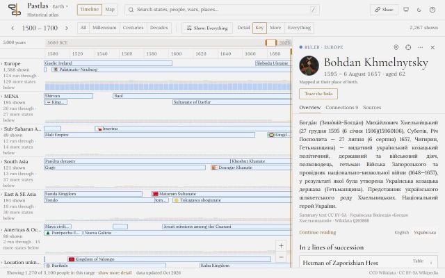
    • Fixed: a sentence dating something to “612 BC” was read as 612 CE.
  72. Theories of instability, tested against the record

    • Investigate
    • Theories
    • Data and accuracy

    Investigate now brings eleven theories from the comparative literature to every case, and a new Compare cases mode tests them across the whole atlas.

    • A library of eleven theories: Goldstone’s demographic-structural breakdown, Turchin’s fathers-and-sons cycle, Ibn Khaldun’s dynastic cycle, Huntington’s modernisation gap, Skocpol and Tilly on war and revolution, Tilly’s multiple sovereignty, Hilton and Cohn on plague and revolt, climate shock (Manning, Büntgen, Parker, Campbell), Fearon and Laitin on state weakness, the conflict trap (Collier, Hoeffler, Walter) and Toynbee’s disintegration. Each carries its sources, its strongest objection, and conditions the atlas can test for any state and year.
    • “What the theories point to” sits directly under “What led to it” and gives every theory one of four answers: its conditions were present, they were tested and absent, they cannot be tested here, or the theory does not ask about this kind of subject.
    • Where a theory’s conditions are met, the things it names become causes “by a theory”, cited to its authors and ranked below anything a source says about the event. The Peasants’ Revolt of 1381 now shows the Black Death in England (Hilton, Cohn). You can filter these links by theory.
    • Compare cases: each theory’s rate across the whole record, with and without its conditions, by region and by how well documented the period is, with the near-misses where the conditions held and nothing followed.
    • Compare up to six cases side by side. An empty cell says why it is empty: checked and nothing found, not known yet, not applicable, or outside the years a dataset covers.
    • “What if a cause is removed” counts what goes with a cause, and never claims to know whether the event would still have happened.
    • Instability on record, by region and half-century, drawn only where enough states and events are recorded to say anything; the rest is hatched and says why.
    • A test of chance: do changes of ruler fall near volcanic winters or severe droughts more often than chance would put them? On this record, no.
    • The area each state held, year by year, measured from Cliopatria’s borders: the Roman Empire at 5.26 million km² in 117.
  73. Evidence you can check, and take with you

    • Investigate
    • Design and reading
    • Sharing and links

    Investigate became stricter about dates and sources, cites historians by name, and lets you keep and share your own judgements.

    • Fixed: a cause is never filed against its own dates. Something that began after the event is no longer listed as what led to it; the Xiongnu’s causes had included Mongolia in 1947.
    • 42 claims argued by historians, each citing the scholarship for and against: Doyle and Schama on the debt behind 1789, Figes and Fitzpatrick on the war behind 1917, Heather against Halsall and Goffart on the Huns and the West, Keynes against MacMillan and Marks on Versailles, Kuhn and Platt on the Taiping and the Qing.
    • Each link names the documents behind it, so you can see which sources agree and which deny it.
    • Mark any link convincing, possible, doubtful or reject. Your judgements travel in the link you share, and a rejected link is set aside where you can find it again.
    • Background data: every dataset the atlas draws on or knows of, drawn as a bar across five thousand years, so you can see at once which reach the year and place you asked about, and what each says there.
    • A path to another entry: the shortest chain of recorded causes and successions between two entries, every step named.
    • Take it with you: the whole investigation as plain text, with its sources and a link back to the view, to copy or download.
    • Keyboard: 1–5 switch the kinds of evidence, d changes the depth, the arrow keys walk the list, ? opens the guide. A third level of depth reaches a war’s battles through its campaigns.
    • The map’s layers and playback speed now travel in the link too.
    • Fixed: people Wikidata links to a war only as participants, such as a novelist and a chemist under the First World War, are no longer listed among its causes.
    • Fixed: on a phone the atlas now offers the map and search, and a search result opens on the map.
  74. What power rested on

    • Map
    • Rulers and reigns
    • Data and accuracy

    States since 1789 show what their rulers’ power rested on, and lines of rulers stop counting prime ministers as monarchs.

    • From V-Dem, for states from 1789: what the chief executive’s power rested on (heredity, the military, a ruling party, elections, the legislature), each on its own track, because the five do not add up to a whole. Coup attempts are listed by year.
    • Fixed: prime ministers were counted as rulers, so Russia showed a one-year median reign. The line of rulers now follows the head of state, and says which office it is a line of.
    • A median reign is shown only where at least 50 years of the line is dated; otherwise the panel says how much is dated.
    • Disasters now say what kind they were: earthquake, flood, eruption, storm, landslide, impact or tsunami.
    • The economy line follows your pointer, and the state’s own wars, plagues, famines, revolts and regime changes are marked on the same axis.
    • Fixed: the year box on the map overlapped the speed buttons beside it.
  75. Hazards, economies and lines of rulers

    • Timeline
    • Rulers and reigns
    • Data and accuracy

    The atlas gains NOAA’s natural hazards, Maddison’s long-run economy and each state’s line of rulers, and a rebuild brings in entries that had been missed.

    • Natural hazards from NOAA: significant eruptions, earthquakes and tsunamis, joined to the atlas’s own entries rather than drawn twice, with a Hazards collection to show them all. Where the two sources disagree on a date, both are kept: NOAA dates Thera to 1610 BCE, Wikidata to 1601.
    • Maddison’s GDP per capita and population under each modern state, labelled as a measure of its territory, and drawn fainter where a figure is one scholar’s reconstruction rather than national accounts.
    • How power changed hands: each state’s rulers drawn as a succession on the same calendar as the timeline, with interregna and overlaps, and a plain note where the record is too thin to measure.
    • Fixed: some states listed rulers who never ruled them, such as Richard I and King Arthur under the Kingdom of Judah. Wrong ruler links fell from 8.1% to 0.8%.
    • Wikidata types the Ming dynasty as a “Chinese dynasty” rather than a “dynasty”, so it had been missed. Narrower classes like these are now included, bringing in the Ming, Tang and Yuan dynasties and the Battle of Lepanto: about 16,100 entries in all.
    • Kinds you can follow: eleven families on the control strip, each showing how many are drawn of how many are held, with “none” and “all” to follow one kind at a time.
    • Six domains instead of three: politics, conflict, nature, culture, science and trade. An earthquake is no longer filed under politics.
    • Fixed: in a long open region, rows could spill under the next region’s heading (Swedish monarchs drawn under the Middle East). The plot now has one scroller and each region is as tall as its content.
  76. Investigate moves onto the timeline

    • Timeline
    • Investigate

    An investigation is now the same timeline with one question asked of it, and every link shows the words it was read from.

    • Investigate is now a mode of the timeline rather than a screen of its own: the question sits above the plot, only the rows that answer it stay, curves join them to the subject, and the reading fills the side rail.
    • The rows a question reaches are drawn whatever the importance floor says, and host states stay as a faint ground marked “where it happened, not a cause”.
    • Click a link to see its evidence: the sentence it was read from with the causal phrase underlined, the section it came from, and how close in time the two things are.
    • Causes are now read from an article’s Background, Causes and Origins sections, and from its Decline and Fall sections when you ask why a state ended.
    • What the article names: every other entry an article mentions, listed apart from its causes.
    • Argued claims: where Wikidata and Wikipedia are silent on a contested cause, the atlas states the argument with the evidence for and against it. The first asks whether the Thera eruption ended Minoan Crete.
    • Answers the atlas does not hold as entries of its own, such as French Madagascar, are now drawn on the timeline too.
    • Type a year into the timeline or the map: “480 BCE” and “-480” both work. The timeline now ends at 2025.
  77. A larger atlas, and the first Investigate

    • Timeline
    • Map
    • Investigate
    • Data and accuracy

    The atlas nearly doubles, every entry opens the right article, and you can ask any entry why it happened.

    • An event now needs an article in 8 Wikipedia language editions to be admitted, down from 20. The atlas grows from about 8,400 to about 15,000 entries, and Europe’s share falls from 54% to 49%, with East Asia and the Middle East gaining ground.
    • The importance floor, which thins the plot by how many Wikipedias cover a row, is now yours to set: type a number to pin it, press “auto” to hand it back, and both travel in the link.
    • Fixed: about one entry in five opened the wrong Wikipedia article. “Siege of Carthage” opened a disambiguation page, “Georgia” the US state and “Seneca” a people; each entry now opens the article its Wikidata item links to.
    • An entry with no English Wikipedia article now says so plainly.
    • Fixed: trade routes crossing the Pacific are no longer drawn across Eurasia.
    • Fixed: a battle is no longer nested under a campaign it cannot belong to, such as the Battle of Kulikovo (1380) under the Mongol invasion of 1237–1240.
    • The first version of Investigate: ask why an entry happened, or for a state why it began and why it ended, and see its causes ranked by the kind of evidence behind them, beside the situation beforehand (rulers who had just died, wars under way, earlier unrest), each saying what it searched when it finds nothing.
  78. Connections that explain

    • Map
    • Investigate
    • Rulers and reigns
    • Cities and places

    An entry’s connections are now read from recorded statements and sorted by cause and effect, and the map gains the peoples who lived between the states.

    • An entry’s connections are read from Wikidata’s statements and sorted into what led to it, what happened during it, and what came of it. Guesses from nearness in time and place are gone: an entry with no recorded connections says so.
    • Each connection says what kind of claim it is: recorded as a cause, linked by a statement such as “part of” or “replaced by”, read from the article, or a coincidence in time and place.
    • Causes read from Wikipedia’s own prose, each shown with the sentence it came from, so a wrong reading can be spotted at a glance.
    • Each state names its rulers, read from the office the state itself names, the best known first.
    • Names inside an article are links, and every dated connection opens, even to things the atlas does not hold as entries.
    • A campaign’s battles are nested under it, so the Mongol Empire’s sieges of Ryazan and Kyiv appear under the invasion that contains them.
    • On the map: 1,665 named ancient peoples and regions from the Barrington Atlas (750 BCE–640 CE), and 885 ethnic groups from a 1964 survey, each drawn only across the period its source describes.
    • Trade corridors grow from 45 to 184.
    • A selected marker stands out in amber, and the status bar says how many states, markers and corridors the map actually drew.
  79. Borders, flags and trade routes

    • Map
    • Cities and places

    The map gains historical borders for every year, the flags that actually flew, and the trade routes that crossed them.

    • Historical borders from Cliopatria redraw with the year, each state in its own colour with its English name. Borders are never interpolated: the map shows the recorded border and says which years it holds for.
    • Each state flies the flag it flew in those years: Hungary in 1400 flies Sigismund’s banner, not the Habsburg black and yellow.
    • Clicking a state opens a card beside the map, and its article where the atlas holds that state in that year: France in 1682 opens the Kingdom of France.
    • Markers show what they are, with an icon for each kind, and people appear with their portraits.
    • Forty-five trade corridors, from the Incense Route and the Silk Road to the Manila galleon, each an entry of its own: what it carried, how much where a source counted it, and how it changed. Beside them, 3,165 Greek and Roman road segments from the Barrington Atlas.
    • A chronicle beside the map lists what began and ended around the year you are on.
    • Press play: the map moves through the years at 1, 10, 40 or 200 years a second.
    • Fixed: Baghdad carried American flags and Doha a British one; each state now has a single label at its largest part.
    • Fixed: the map could get stuck on an error screen after a minor tile error; it no longer does, and it has a “Try again” button.
  80. The first build

    • Timeline
    • Map
    • Data and accuracy
    • Sharing and links

    A timeline and a map of five thousand years, built from Wikidata, with every article read inside the atlas.

    • A synchronoptic timeline of Wikidata’s states, events, people and works from 3000 BCE, in six world regions and an “Unplaced” lane.
    • Click any bar to read its Wikipedia article inside the atlas, search by name, switch to the map, and copy the URL to share the exact view.
    • Entries Wikidata gives no coordinates inherit a place from where they happened or who made them: unplaced entries fell from 38% to 2.4%, and each entry says how it was placed.
    • Every entry is filed by kind (battle, siege, treaty, plague, ruler, scientist and more) with its own colour and icon.
    • Open one region to read its states with the people, events and works they hosted beneath them, and pin another to compare; the other regions stay visible on the same axis.
    • Each person, event and work is placed under the state that hosted it, checked against the dates: Leonardo under the Republic of Florence, not Italy, which did not yet exist.
    • Click to fix the year; picking something off screen takes the timeline and the map to it.
    • Early states such as Ancient Egypt, Sumer and Uruk are kept with their true founding dates.
    • Piracy and Instability collections, picked from the control strip.
    • Fixed: BCE dates from Wikidata were a year out. Julius Caesar is now born in 100 BCE.
    • Fixed: people were drawn on the map after their deaths.
    • Fixed: anyone who had ever served in an army was filed as a commander; Tacitus, Cicero and Gagarin now read as a politician, a philosopher and an explorer.