State · 1463 – 1859
Principality of Svaneti
A state of 1463 – 1859 — 396 years in Europe. Its line of rulers holds 1 person. Its own article says it was conquered by Russian Empire.
For the full story, the article on Wikipedia (CC BY-SA 4.0); this page holds what the record says of the state.
- Stood
- 396 years
- 1463 – 1859
- Rulers
- 1
- the Prince of Svaneti
- Most ground
- 2,700 km²
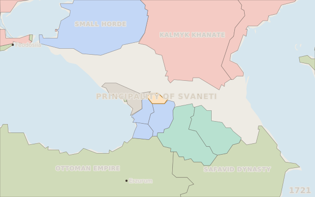
- in 1721
- Symbol
- 1
- on record, with years
Where it sits in time
Five thousand years, 3000 BCE to 2026; the state in gold.
How it ended, as its article says
Conquered by Russian Empire, 1858. Read from the article's section “lead” by its grammar; the claim is only that the article says so.
It was ruled successively by the houses of Gelovani and Dadeshkeliani, and was annexed to the Russian Empire in 1858.
One sentence of the English Wikipedia article, CC BY-SA 4.0.
Rulers
Read from the state’s own English article and its rulers’ articles, where Wikidata names no ruler.
| Ruler | Reign | Length | How it ended · source | To the ruler before |
|---|---|---|---|---|
| Konstantine Dadeshkeliani | 1826 – 1857 | 31 years | deposed, the article saysread from the ruler's own article |
1 rulers, 1 with terms dated as terms, covering 1826 – 1857. Only 31 years of the line are dated - too short for a median. A blank in the last column means no kin on record, which is coverage, never “unrelated”.
Ground held, by year
km² inside its borders as the borders dataset draws them, measured on an equal-area grid; a step series, held between the years the dataset maps.
2,700 km² in 1738, 2,400 km² in 1813; at its largest 2,700 km² in 1738. Cliopatria, CC BY 4.0.
Flag or arms
Each symbol with the years its own statement gives; the timeline flies the one of the year on screen.

coat of arms, undatedCoat of arms of Svaneti · CC0
Among all states
Each measure against the states that carry it, never against all of them: a bar is the share of those states below this one.
- How long it stood396 years
stood longer than 80% of 3,187 states with a recorded end or still standing.
- The most ground it held2,700 km²
held more ground at its peak than 6% of 1,465 states with a border in Cliopatria.
- Wars recorded per centurynone
had more wars on record per century than 44% of 3,187 states, counting the wars the atlas hosts under each.
- Rulers on record1
has more rulers on record than 13% of 1,968 states with a line of rulers.
What led to it, and what came of it
The investigation's own picture: 2 causes the record names and 0 results, the strongest six of each at their own years, joined to the state by the kind of claim - a recorded statement solid, the article's sentence dashed, a theory dash-dot.
Open the investigation: every row with its evidence, the conditions at the time, the theories condition by condition, and the succession analysed.
Open in the atlas
- On the timeline, 1423 – 1899, with everything that stood beside it.
- On the map in 1721, live: scrub the year and watch its borders move.
- Investigate it: what led to it, what came of it, and its succession analysed.
Wikidata Q2919545 (CC0) · borders Cliopatria, CC BY 4.0 · coast and rivers Natural Earth · symbols from Wikimedia Commons, each credited above · one sentence of the English Wikipedia article, CC BY-SA 4.0 · data built 2026-10-06 · Pastlas v2.9.1, by Oleh Voronko. The published atlas and its data are for non-commercial use.