State · 1237 – 1659
County of Artois
A state of 1237 – 1659 — 422 years in Europe. Its line of rulers holds 3 people.
For the full story, the article on Wikipedia (CC BY-SA 4.0); this page holds what the record says of the state.
- Stood
- 422 years
- 1237 – 1659
- Rulers
- 3
- the Count of Artois, Burgundy, and Charolais (claim since 1482, effectively since 14
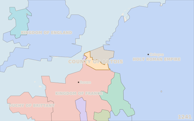
- Most ground
- 7,600 km²
- in 1241
- Symbols
- 2
- on record, with years
Where it sits in time
Five thousand years, 3000 BCE to 2026; the state in gold.
Rulers
Read from the state’s own English article and its rulers’ articles, where Wikidata names no ruler.
| Ruler | Reign | Length | How it ended · source | To the ruler before |
|---|---|---|---|---|
| Robert I of Artois | 1237 – 1250 | 13 years | ending not on record | |
| Joan III of Burgundy | 1330 – 1347 | 17 years | ending not on record | |
| John the Fearless | 1404 – 1419 | 15 years | ending not on record |
3 rulers, 3 with terms dated as terms, covering 1237 – 1419. Median reign 15 years. 0 of 2 handovers irregular - a killing, a deposition, a rival claimant, a rising or a coup beside it. A blank in the last column means no kin on record, which is coverage, never “unrelated”.
Ground held, by year
km² inside its borders as the borders dataset draws them, measured on an equal-area grid; a step series, held between the years the dataset maps.
7,600 km² in 1262, 7,600 km² in 1312; at its largest 7,600 km² in 1262. Cliopatria, CC BY 4.0.
Flags and arms, in order
Each symbol with the years its own statement gives; the timeline flies the one of the year on screen.

coat of arms, undatedBlason comtes fr d'Artois 1 · CC BY-SA 4.0 
flag, undatedFlag of Artois · CC0
Among all states
Each measure against the states that carry it, never against all of them: a bar is the share of those states below this one.
- How long it stood422 years
stood longer than 82% of 3,187 states with a recorded end or still standing.
- The most ground it held7,600 km²
held more ground at its peak than 13% of 1,465 states with a border in Cliopatria.
- Wars recorded per centurynone
had more wars on record per century than 44% of 3,187 states, counting the wars the atlas hosts under each.
- How long a reign lasted, at the median15 years
had longer reigns, at the median, than 49% of 967 states whose dated line can carry a median.
- Rulers on record3
has more rulers on record than 48% of 1,968 states with a line of rulers.
Open in the atlas
- On the timeline, 1195 – 1701, with everything that stood beside it.
- On the map in 1241, live: scrub the year and watch its borders move.
- Investigate it: what led to it, what came of it, and its succession analysed.
Wikidata Q778266 (CC0) · borders Cliopatria, CC BY 4.0 · coast and rivers Natural Earth · symbols from Wikimedia Commons, each credited above · data built 2026-10-06 · Pastlas v2.9.1, by Oleh Voronko. The published atlas and its data are for non-commercial use.